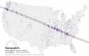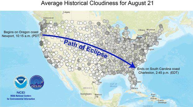
The darker the dot, the greater the chance for cloudiness at the hour of peak viewing during the total solar eclipse on August 21, 2017. Dots represent automated weather stations that reported the cloudiness data and show the 10-year cloudiness average for August 21, 2001–2010.
(Source: ncei.noaa.gov)
Related Posts