
 Home/Blog
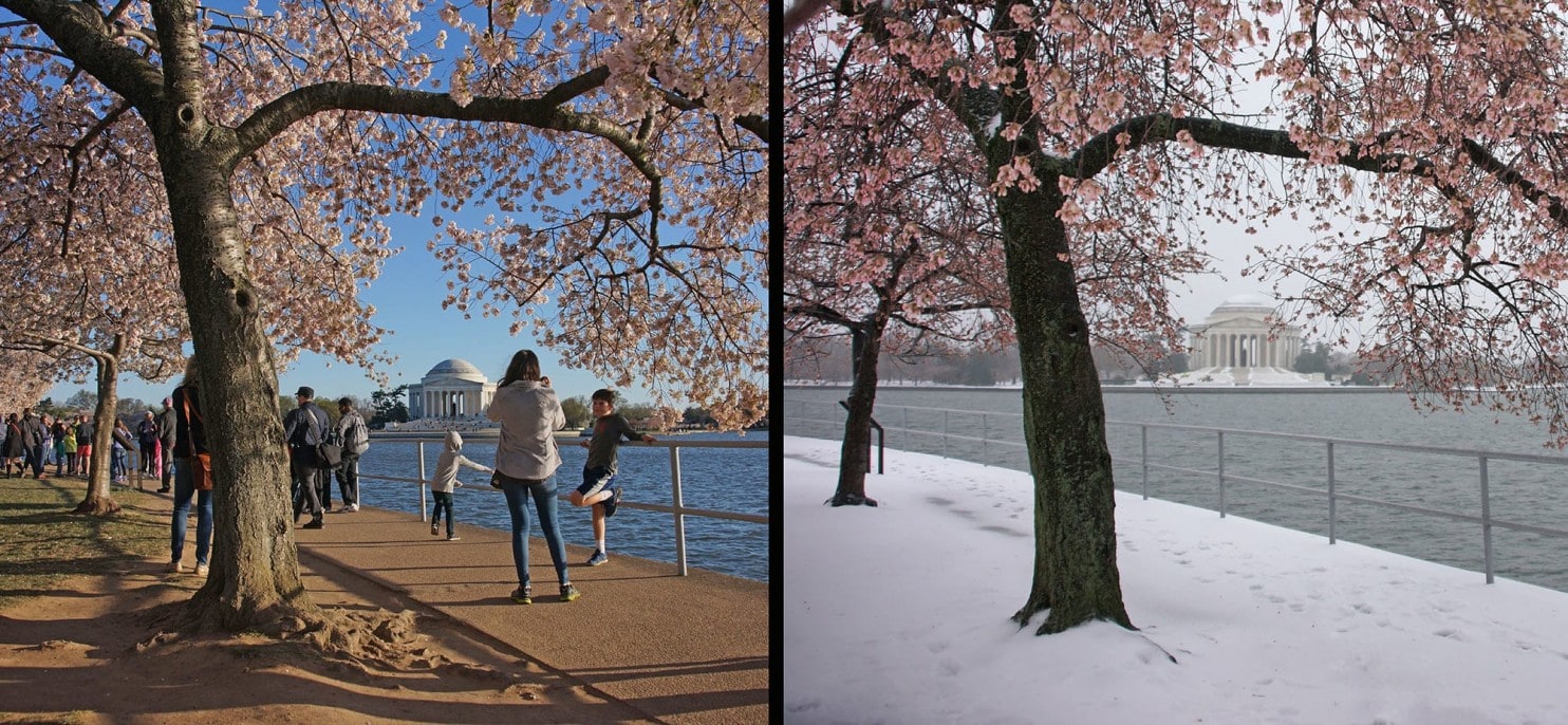
Tidal Basin cherry blossoms on March 29, 2016 (left); and then on March 14, 2017 after an early blossom then snow (right). Photo by Kevin Ambrose, Washington Post.
After continuing delays due to cold weather, the National Park Service’s daily update for the DC Tidal Basin cherry blosson predicts that the peak blossom time will finally be this weekend.
But you might want to get out the snow shovel if you want to go see this annual event.
The latest weather forecast models are predicting anywhere from 6 to 18 inches of snow by Sunday morning, beginning late Friday night, April 6 (all forecast graphics courtesy of Weatherbell.com):
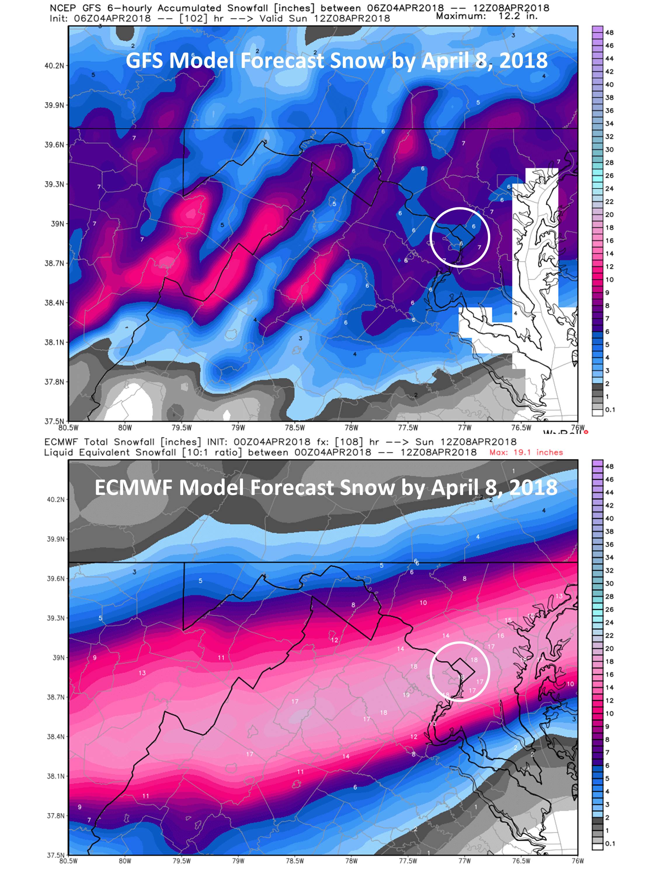
Weather model forecasts of total snowfall by Sunday morning, April 8, 2018. The DC metro area is in the circle. All forecast graphics courtesy of Weatherbell.com.
The swath of snow forecast to affect the DC area is unusually far south for April, as seen in the ECMWF forecast ending Sunday morning for the eastern U.S.:
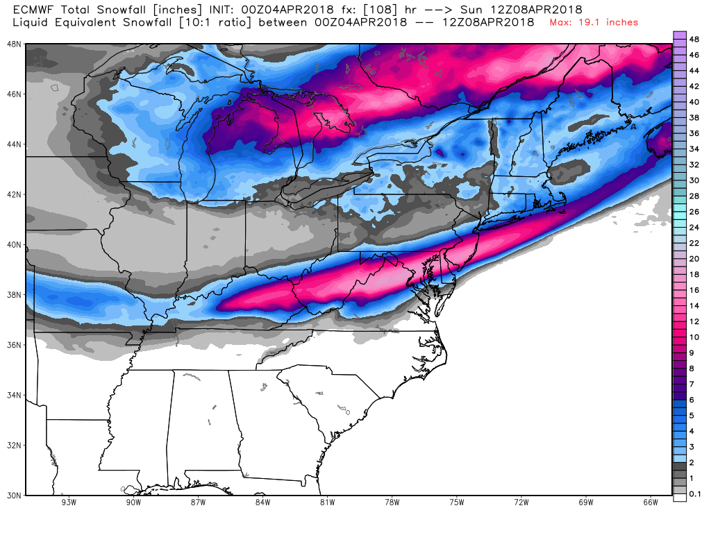
Total forecast snowfall from the ECMWF model as of Sunday morning, April 8, 2018 for the eastern U.S.
And if you think this is just a temporary cold shot that will immediately give way to warmer temperatures, here’s the GFS model forecast of temperature departures from normal averaged over the next 10 days, which shows a widespread area averaging 10-12 deg F below normal:
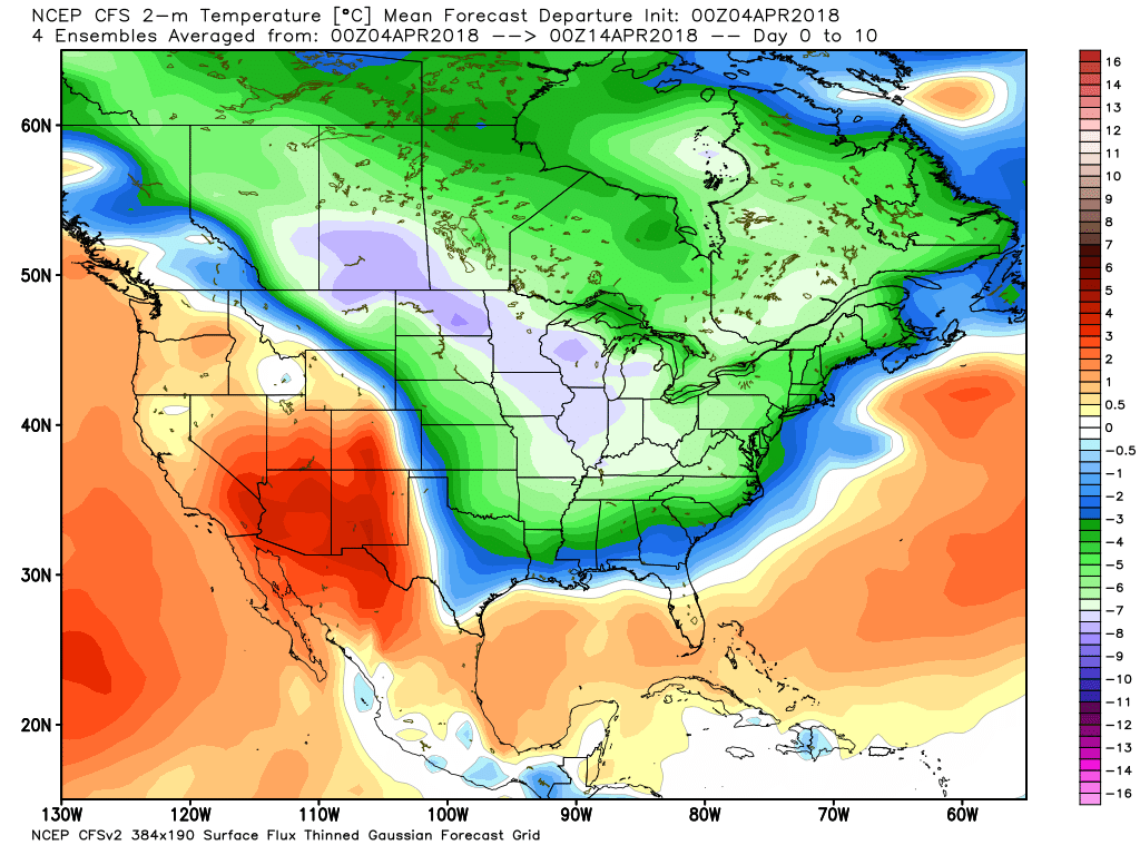
GFS model forecast of 10-day average temperature departures from normal for the period April 4 through April 13.
That’s the average over the next 10 days. On most individual days in the period, some areas will be 20-30 deg. F below normal.


