File:Desna river Vinn meadow 2016 G2.jpg
Jump to navigation
Jump to search
Size of this preview: 800 × 533 pixels. Other resolutions: 320 × 213 pixels | 640 × 427 pixels | 1,024 × 683 pixels | 1,280 × 853 pixels | 2,560 × 1,707 pixels | 6,000 × 4,000 pixels.
Original file (6,000 × 4,000 pixels, file size: 8.53 MB, MIME type: image/jpeg)
Captions
Captions
Add a one-line explanation of what this file represents
Summary[edit]
| Description |
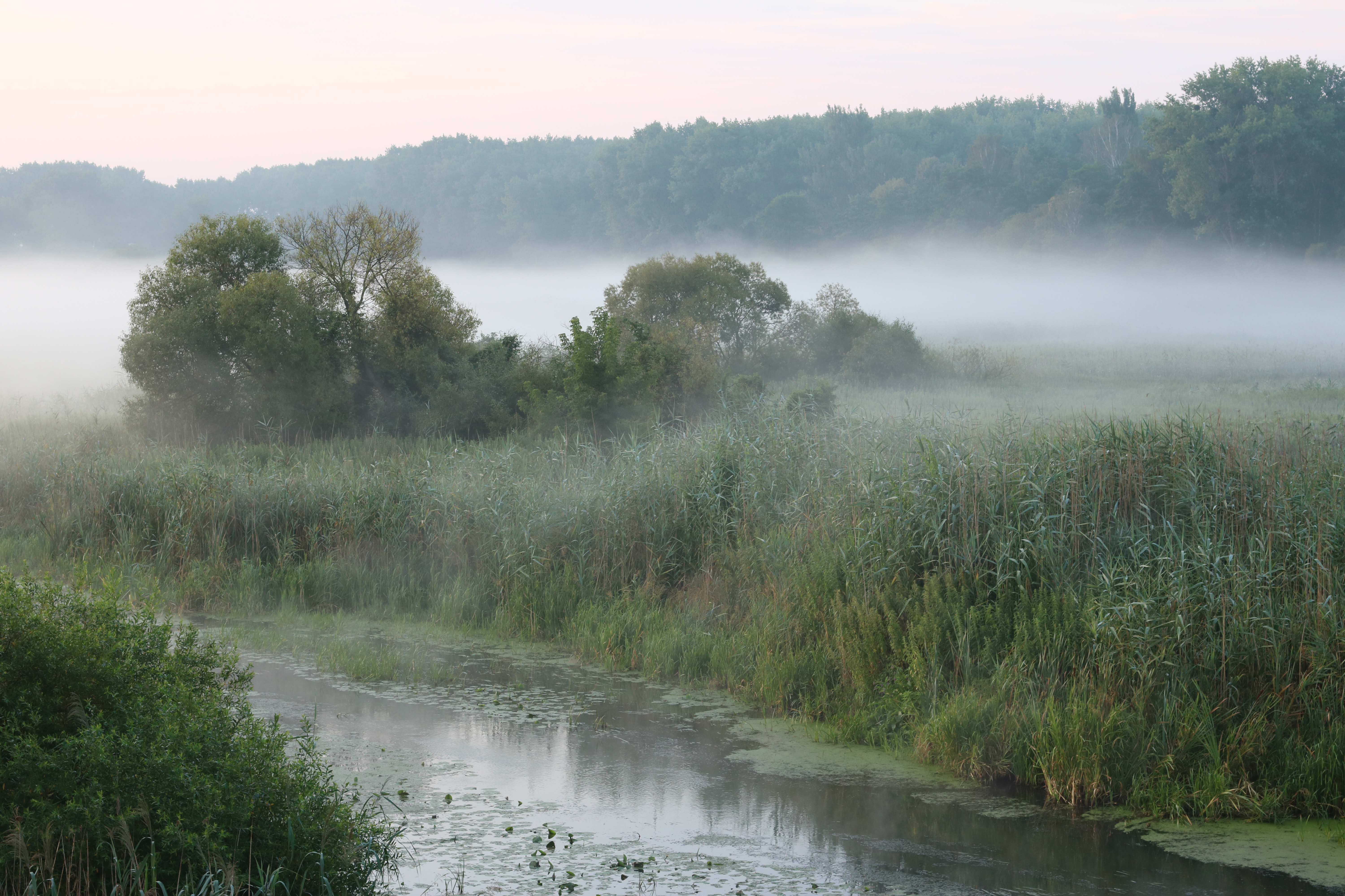
English: Desna river, feeder of the Southern Bug, at meadow. Ukraine, Vinnytsia Raion
Македонски: Реката Десна, притока на Јужен Буг, низ магловита ливада во околината на Виница, југозападна Украина.
Nederlands: De Desna voedt onder meer de Zuidelijke Boeg, die dwars door de Oekraïense oblast Vinnytsja stroomt
|
||
| Date | |||
| Source | Own work | ||
| Author | George Chernilevsky | ||
| Permission (Reusing this file) |
|
| Camera location | | View this and other nearby images on: OpenStreetMap |
|---|
Assessment[edit]
|
This image was selected as picture of the day on Wikimedia Commons for 26 June 2019. It was captioned as follows: English: Desna river, feeder of the Southern Bug, at meadow. Ukraine, Vinnytsia Raion Other languages:
English: Desna river, feeder of the Southern Bug, at meadow. Ukraine, Vinnytsia Raion Nederlands: De Desna voedt onder meer de Zuidelijke Boeg, die dwars door de Oekraïense oblast Vinnytsja stroomt |
File history
Click on a date/time to view the file as it appeared at that time.
| Date/Time | Thumbnail | Dimensions | User | Comment | |
|---|---|---|---|---|---|
| current | 12:21, 27 May 2018 | | 6,000 × 4,000 (8.53 MB) | George Chernilevsky (talk | contribs) | User created page with UploadWizard |
You cannot overwrite this file.
File usage on Commons
The following 30 pages use this file:
- Featured Photographs in the Public Domain
- User:Eatcha/POTY-2018-Round-1-Results
- User:Spinster/Desktop pictures
- User talk:George Chernilevsky/Archive/Archive 2018 2
- Commons:Featured picture candidates/File:Desna river Vinn meadow 2016 G2.jpg
- Commons:Featured picture candidates/Log/June 2018
- Commons:Featured pictures/Places/Natural
- Commons:Featured pictures/chronological/2018-A
- Commons:Picture of the Year/2018/Candidates
- Commons:Picture of the Year/2018/R1/Gallery/2018-A
- Commons:Picture of the Year/2018/R1/Gallery/ALL
- Commons:Picture of the Year/2018/R1/Gallery/M06
- Commons:Picture of the Year/2018/R1/Gallery/Nature views
- Commons:Picture of the Year/2018/R1/v/Desna river Vinn meadow 2016 G2.jpg
- Commons:Quality images/Subject/Places/Natural structures/archive 2018
- Commons:Quality images candidates/Archives May 30 2018
- Template:Potd/2019-06
- Template:Potd/2019-06-26
- Template:Potd/2019-06-26 (cs)
- Template:Potd/2019-06-26 (en)
- Template:Potd/2019-06-26 (es)
- Template:Potd/2019-06-26 (hu)
- Template:Potd/2019-06-26 (it)
- Template:Potd/2019-06-26 (mk)
- Template:Potd/2019-06-26 (nl)
- Template:Potd/2019-06-26 (pl)
- Template:Potd/2019-06-26 (pt)
- Template:Potd/2019-06-26 (pt-br)
- Template:Potd/2019-06-26 (ru)
- Template:Potd/2019-06-26 (uk)
File usage on other wikis
The following other wikis use this file:
- Usage on be-tarask.wikipedia.org
- Usage on bn.wikipedia.org
- Usage on crh.wikipedia.org
- Usage on cv.wikipedia.org
- Usage on en.wikipedia.org
- Usage on hu.wikipedia.org
- Usage on hy.wikipedia.org
- Usage on ja.wikipedia.org
- Usage on ka.wikipedia.org
- Usage on ko.wikipedia.org
- Usage on lbe.wikipedia.org
- Usage on lez.wikipedia.org
- Usage on lt.wikipedia.org
- Usage on mk.wikipedia.org
- Usage on os.wikipedia.org
- Usage on pnb.wikipedia.org
- Usage on pt.wikipedia.org
- Usage on ru.wikipedia.org
- Usage on ru.wikinews.org
- Usage on sah.wikipedia.org
- Usage on sl.wikipedia.org
- Usage on sq.wikipedia.org
- Usage on tt.wikipedia.org
- Usage on uk.wikipedia.org
- Usage on vep.wikipedia.org
- Usage on zh.wikipedia.org