
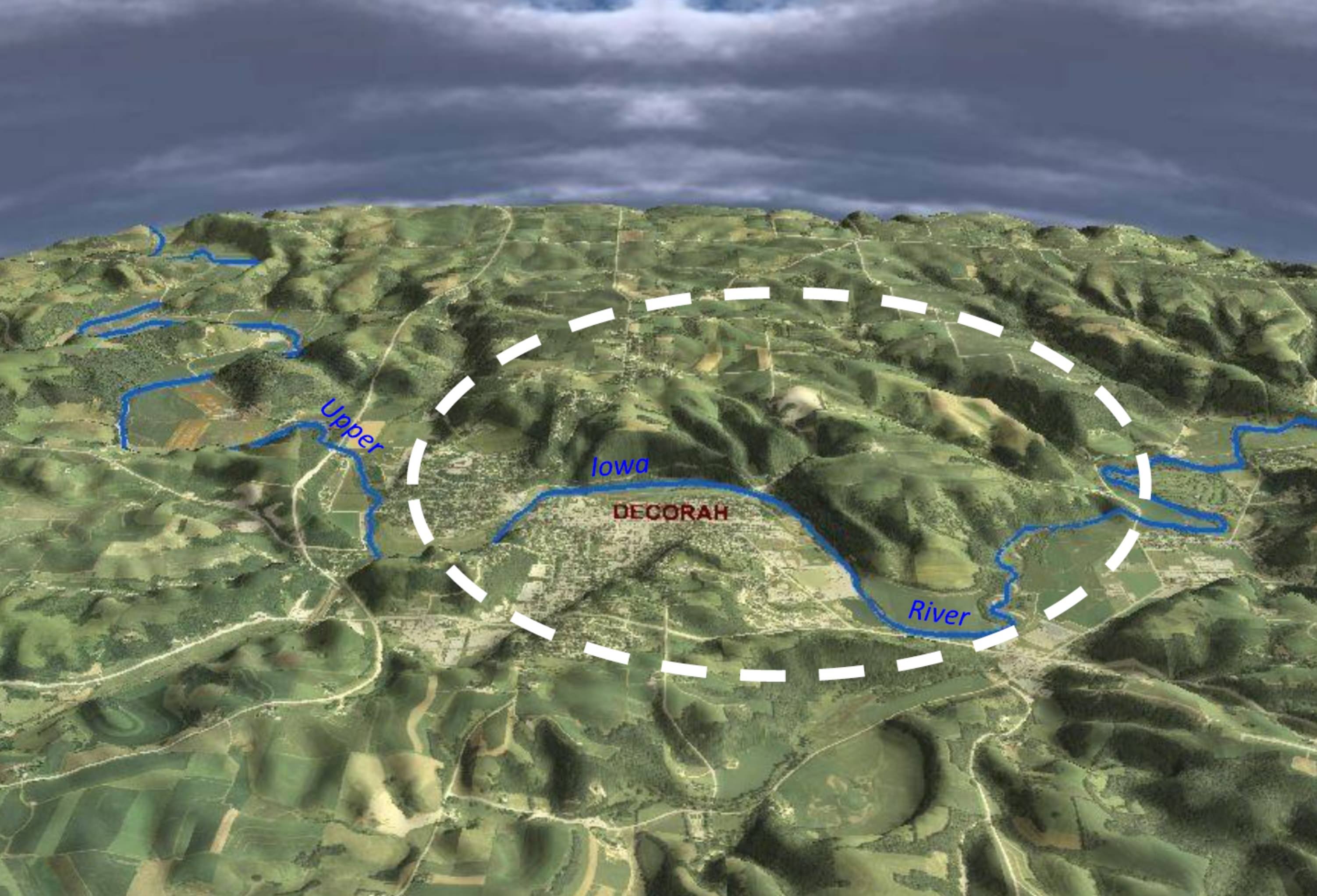
A monster lurks under northeastern Iowa. That monster is in the form of a giant buried basin, the result of a meteorite impact in central North America over 470 million years ago.
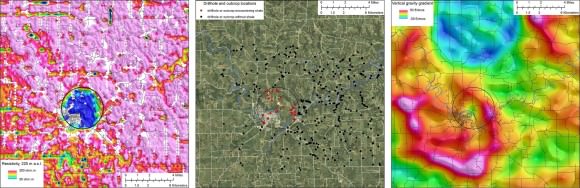
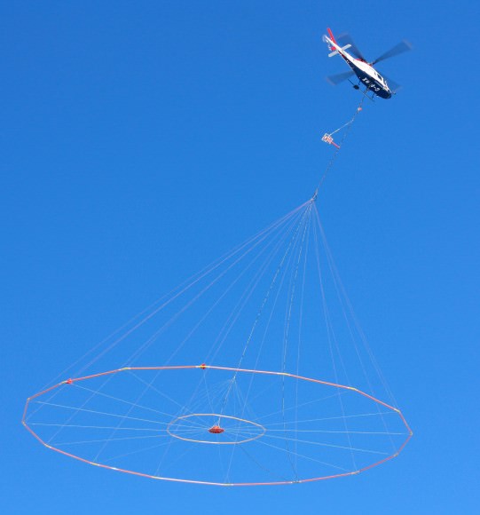
A recent aerial survey conducted by the state of Minnesota Geological Survey and the United States Geological Survey (USGS) confirms the existence of an impact structure long suspected near the eastern edge of the town of Decorah, Iowa. The goal of the 60 day survey was a routine look at possible mineral and water resources in the region, but the confirmation of the crater was an added plus.
“These findings highlight the range of applications that these geophysical methods can address,” Says, USGS geophysicist Paul Bedrosian. The surveys were carried out using a combination of airborne gravity gradiometry to measure relative rock density and an airborne electromagnetic system capable of measuring how rocks conduct electrical currents.
The basin has been under scrutiny for possible meteoritic origin since its initial discovery of unique rock structures in well drillings retrieved in the region by amateur geologist Jean Young about a decade ago. The impact dates from the Middle Ordovician period almost half a billion years ago, which includes an impact chain across central North America from the Ames crater in Oklahoma to the Slate Islands crater in northern Lake Superior.
Presumably, a large L-type chondrite asteroid broke up headed at an oblique angle over the prehistoric terrain. At 5.5 kilometres in diameter, the 200 metre-sized asteroid would have hit forming the Decorah crater with a force of 1,000 megatons of TNT. For contrast, the February 15th 2013 Chelyabinsk event exploded over Russia with the force of 440 kilotons, about 0.04% of the force that created the Decorah crater. The 1908 Tunguska event and the impact that formed the famous Barringer meteor crater near Flagstaff Arizona generated 15 and 10 megaton explosions, respectively.
Like many craters on Earth, most of the surface evidence of the Decorah crater has been obliterated by erosion and deposition. Geologists further identified the existence of shocked quartz preserved beneath a deposition of shale over the circular structure of the impact. The layer of Winneshiek Shale is over 15 metres below the Upper Iowa River bottom. Shocked quartz is a classic “smoking gun” for a historic meteorite impact structure.
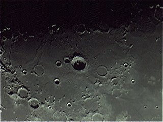
Of course, most ancient impact structures on Earth go unnoticed, right beneath our feet. The advent of aerial photography just before World War II led to the discovery of several new craters such as circular Clearwater Lakes in the remote reaches of Quebec. Impact craters have even been found in the Australian Outback by dedicated sleuths using Google Earth and doubtless more are waiting to be found. One only has to look at the record preserved on the battered face of the Moon to realize it’s a cosmic shooting gallery out there.
Iowa also boasts another hidden impact crater, the enormous 15 kilometre in diameter Manson crater in Humboldt County. This impact occurred “only” 74 million years ago and would’ve leveled trees for a radius of 180 kilometres. A similar event resulted in the Chesapeake Bay crater 35 million years ago during the late Eocene Epoch and a massive North American impact has been debated as the cause of an extinction during the Younger Dryas 13,000 years ago.
A computer generated map of meteorite impacts worldwide also made its rounds on the internet recently. The interactive map displays a much more recent picture of every recorded impact over the last 4,300 years. While interesting to explore, the map also displays the artifacts of some statistical biases common with meteor hunting. One, the density of meteorite impacts roughly coincides with where the human population densities are highest, as that’s what we have records of. Meteorites can and do fall in the oceans or in the Arctic, there’s just not the same level of documentation of them. Two, meteorites and meteorite craters are more likely to be discovered in areas with low erosion (i.e. deserts). For example, you’ll notice high concentrations of impacts on the map in the Australian Outback, the U.S. Southwest and the Empty Quarter of Saudi Arabia, but little data on a swiftly changing (and remote) environment like the Amazon River Basin. But on the plus side, the map is a great teaching tool… and hey, who doesn’t look at it and wonder if there’s an impact crater near their home town?
Discoveries such as the Decorah Crater remind us that such cataclysmic events, while rare, do indeed happen. They also show us a fine example of surreptitious discoveries in routine science.
“These data… will form the basis for modeling efforts to constrain the impact geometry and energy of the meteorite,” Says USGS geophysicist Andy Kass.
Perhaps all is not what it appears to be, both beneath the calm cornfields of Iowa and our own cosmic neighborhood. Is there an ancient impact waiting to be uncovered in your backyard?
“At 5.5 kilometres in diameter, the 200 metre-sized asteroid” – what does this mean? Is it 5.5 Km or 200 M ?
The crater made was 5.5 Km. the asteroid itself was roughly 200 meters. a crater is always quite a bit larger than the object that caused it
Thanks John, I was reading it wrong
Stuart
I think those are big sinkholes and not asteroid impact craters.
darkmattersalot.com