
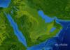
3d rendering of the Arabian Peninsula and East Africa from space.
(Source: shutterstock.com)
Related Posts


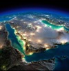


3d rendering of the Arabian Peninsula and East Africa from space.
(Source: shutterstock.com)
 adventuresong reblogged this from trailflow
  mcgregorwashere liked this
  dommaturewomn liked this
  sharji7-blog liked this
  onlymyselfandi reblogged this from toshiagain rimjobaftertaste reblogged this from toshiagain
  bi-boomer liked this
  wirewritings liked this
  sprachschlampe liked this
  novalis93 liked this