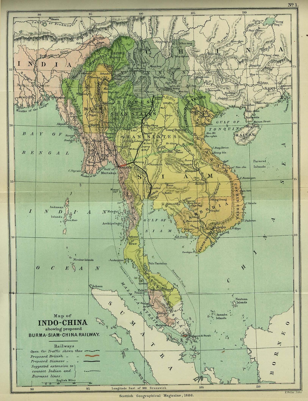
Map of the Southeast Asian mainland in 1886.
(Source: commons.wikimedia.org)
Related Posts
![East Asia population density, absolute amount of 1.5 million people per surface.
[[MORE]] wardantwerp:
After Europe and Latin America, it’s time for East Asia!
I wasn’t satisfied with the existing population density maps because they never show...](https://64.media.tumblr.com/786814c7e16dc30fd15404a9c3c28dd2/tumblr_pozzmaAWZn1rasnq9o1_100.jpg)


 sunseted liked this
  sebastianpuddy reblogged this from prostak-com prostak-com liked this
  theegoist liked this
  le-moine-mort liked this
  gtunesmiff liked this
  canidecideonthislater reblogged this from mapsontheweb skullumio reblogged this from mapsontheweb
  sullengiiirl reblogged this from mapsontheweb sullengiiirl liked this
  joliettemoontear liked this
  faceitimanasshole reblogged this from muchymozzarella faceitimanasshole liked this
  wastedawayagaininmargaritaville liked this
  luncheon-aspic reblogged this from mapsontheweb luncheon-aspic liked this