Mexico is an enormous and diverse country, with approximately 120 million people living in 770,000 square miles (2 million sq km). Modern Mexicans, as well as prehistoric cultures, have been reshaping the land to their needs for centuries, much of that impact visible from aerial and satellite photography—from pyramids and canals to resorts, enormous cities, ports, farms, aquaculture, and more. Over the past week, I took a virtual tour with Google Earth, and wanted to share some of these snapshots of the human landscape in Mexico. See also, earlier tours: Human Landscapes of Canada, and the American Southwest.
Human Landscapes of Mexico
Hints:
View this page full screen.
Skip to the next and previous photo by typing j/k or ←/→.
-
![]()
-
-
![]() Read more
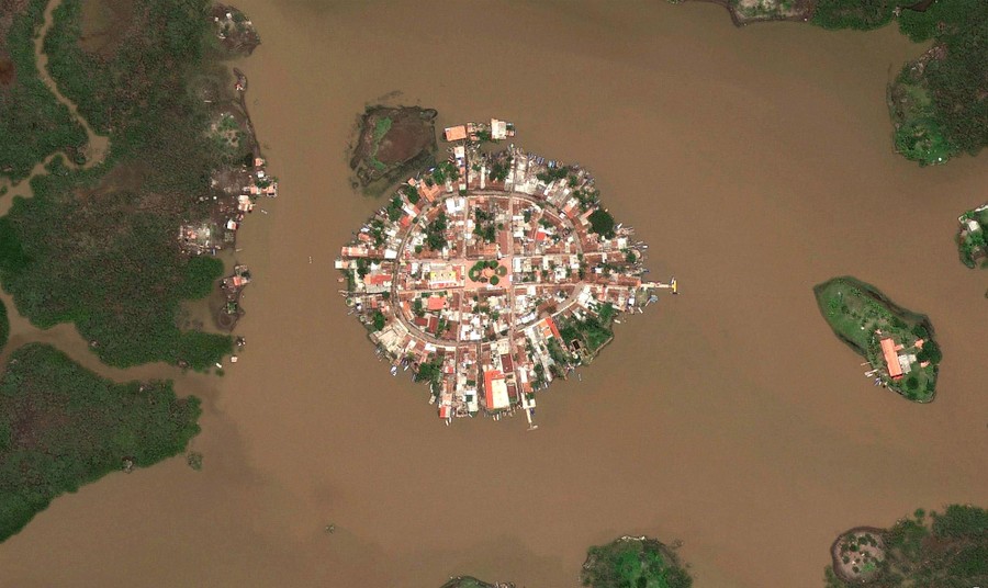
Read moreMexcaltitan de Uribe, a man-made island-city in part of the Laguna Grande de Mexcaltitán. #
© Google, Inc. -
![]() Read more
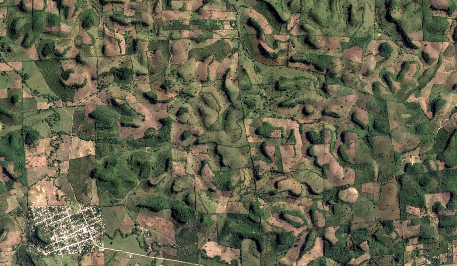
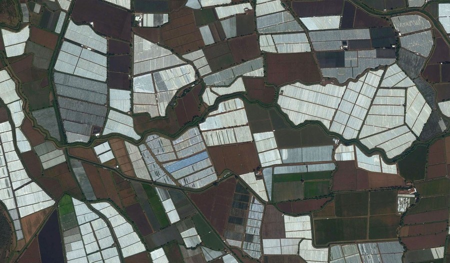
Read moreFields among rolling hills in El Volador, Veracruz. #
© Google, Inc. -
![]() Read more
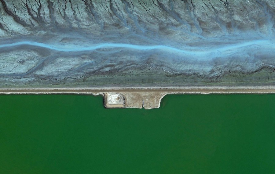
Read morePart of the Planta de Energía Geotérmica Cerro Prieto, near Nuevo León, Baja California. #
© Google, Inc. -
-
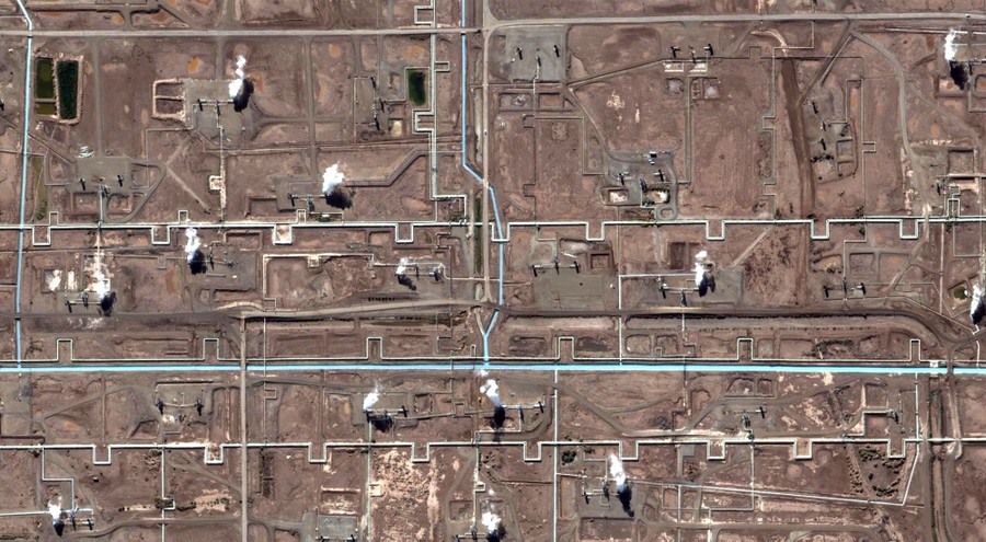
![]() Read more
Read morePipes, canals, and other infrastructure of the Planta de Energía Geotérmica Cerro Prieto, near Nuevo León, Baja California. #
© Google, Inc. -
![]()
-
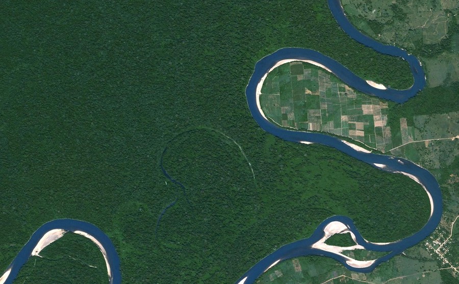
![]() Read more
Read moreA bend in Río Lacantún, Chiapas. #
© Google, Inc. -
-
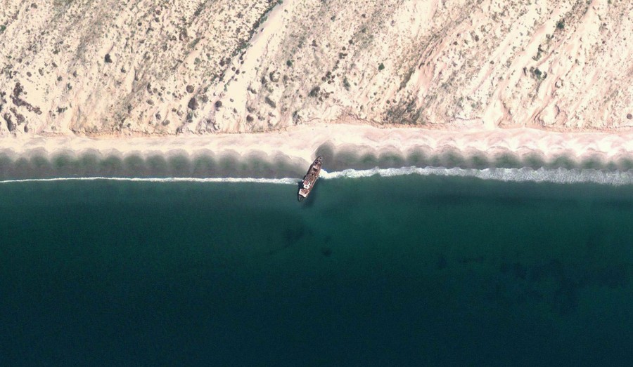
![]() Read more
Read moreA shipwreck in Magdalena Bay. #
© Google, Inc. -
![]() Read more
Read moreA village near El Naranjit, Tabasco. #
© Google, Inc. -
![]()
-
-
![]()
-
![]()
-
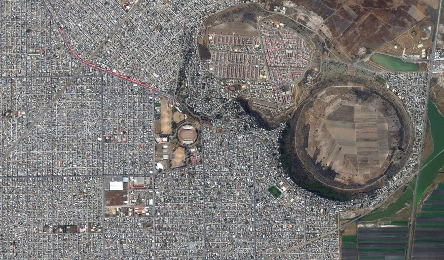
![]() Read more
Read moreXicotencatl Park, at lower right, inside a dormant volcanic caldera, in Mexico City. #
© Google, Inc. -
-
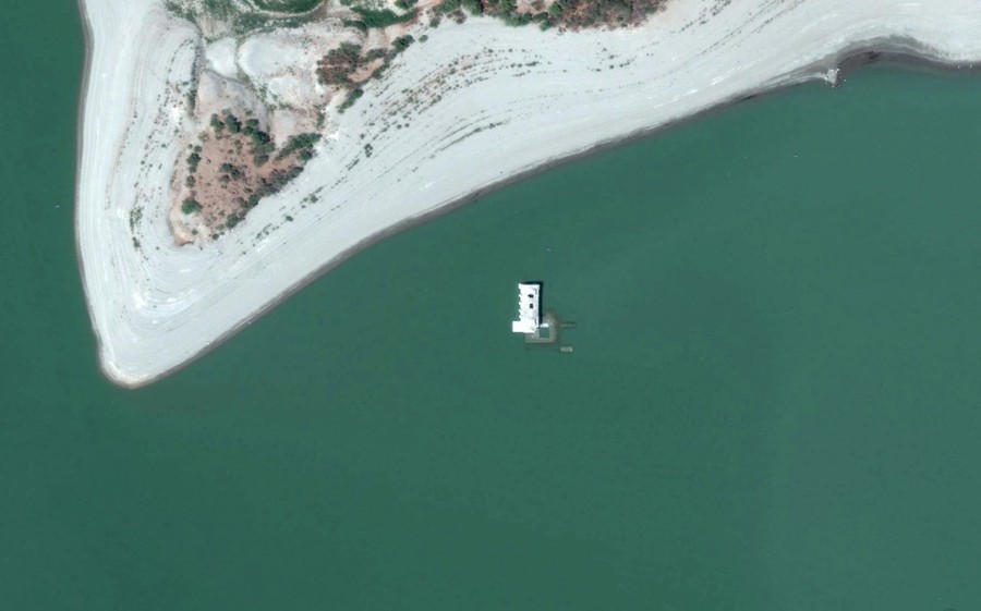
![]() Read more
Read moreA submerged church in a reservoir near Jalapa del Marqués, Oaxaca. #
© Google, Inc. -
![]() Read more
Read moreComalcalco Pyramids, a Mayan archaeological site in the state of Tabasco. #
© Google, Inc. -
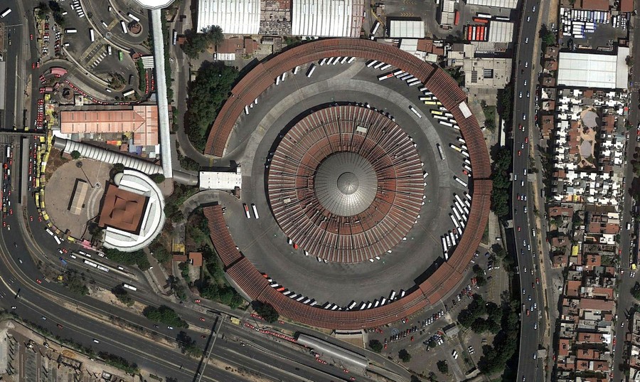
![]() Read more
Read moreEast Bus Station, Mexico City. #
© Google, Inc. -
-
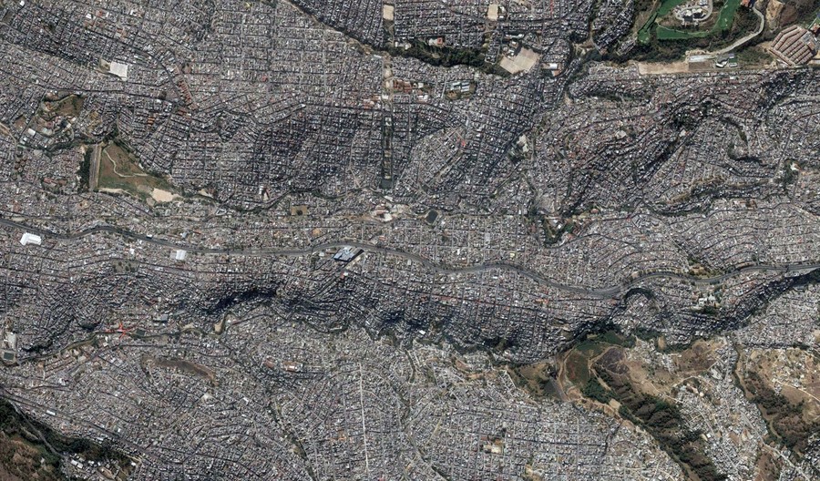
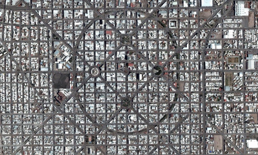
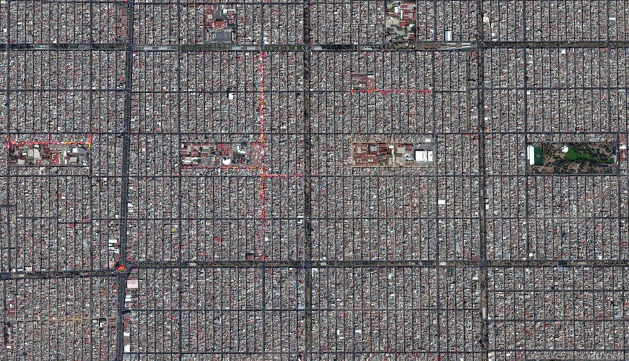
![]() Read more
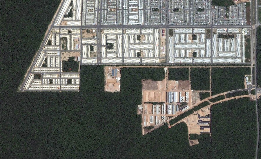
Read moreA grid of streets in Mexico City. #
© Google, Inc. -
![]()
-
![]() Read more
Read moreFarm fields surround a hill near Tlahuelilpan. #
© Google, Inc. -
-
![]()
-
![]() Read more
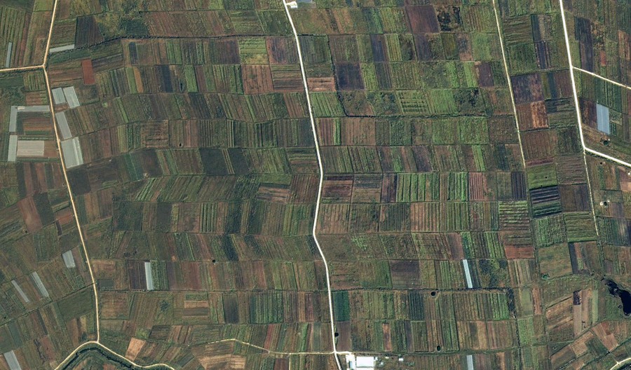
Read moreFarm fields near El Triunfo, Chiapas. #
© Google, Inc. -
![]() Read more
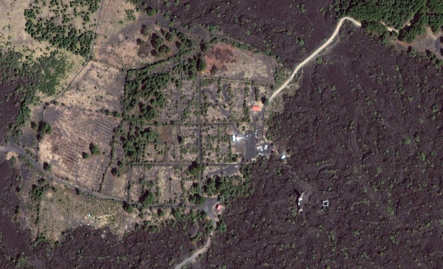
Read moreA church buried under lava (lower right), Iglesia de San Juan Parangaricutiro, near Angahuan, Michoacán. #
© Google, Inc. -
-
![]() Read more
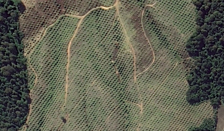
Read moreTrees cut into plots for a planned development on Mexico's Caribbean coast, in Quintana Roo. #
© Google, Inc. -
![]() Read more
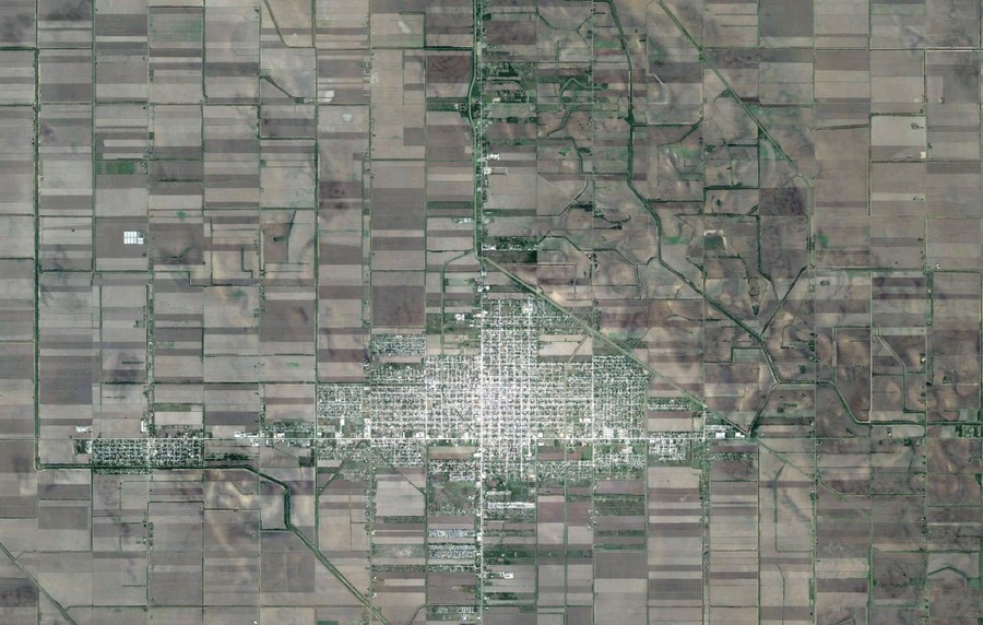
Read moreFarm fields and houses in Campo Menonita, Chihuahua. #
© Google, Inc. -
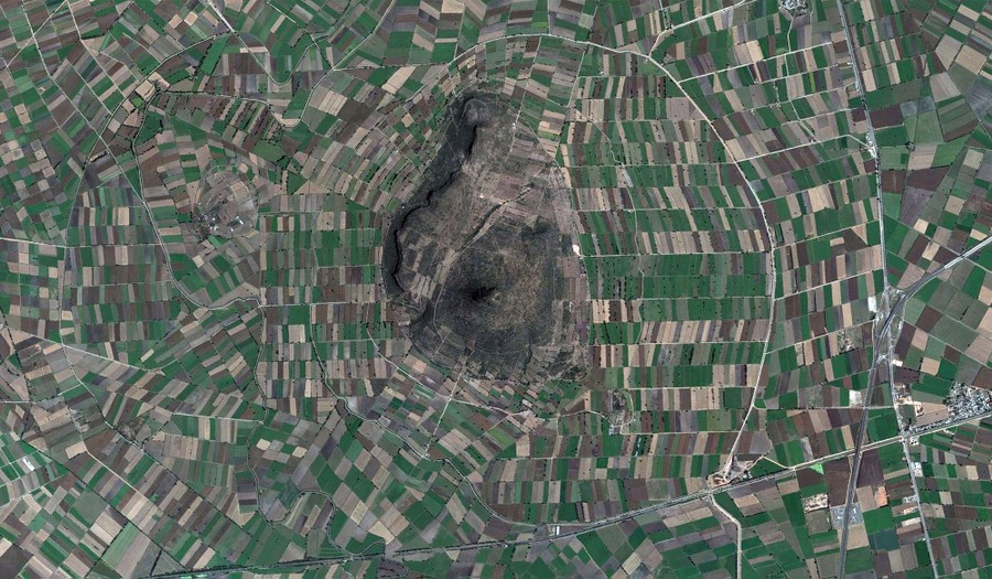
![]() Read more
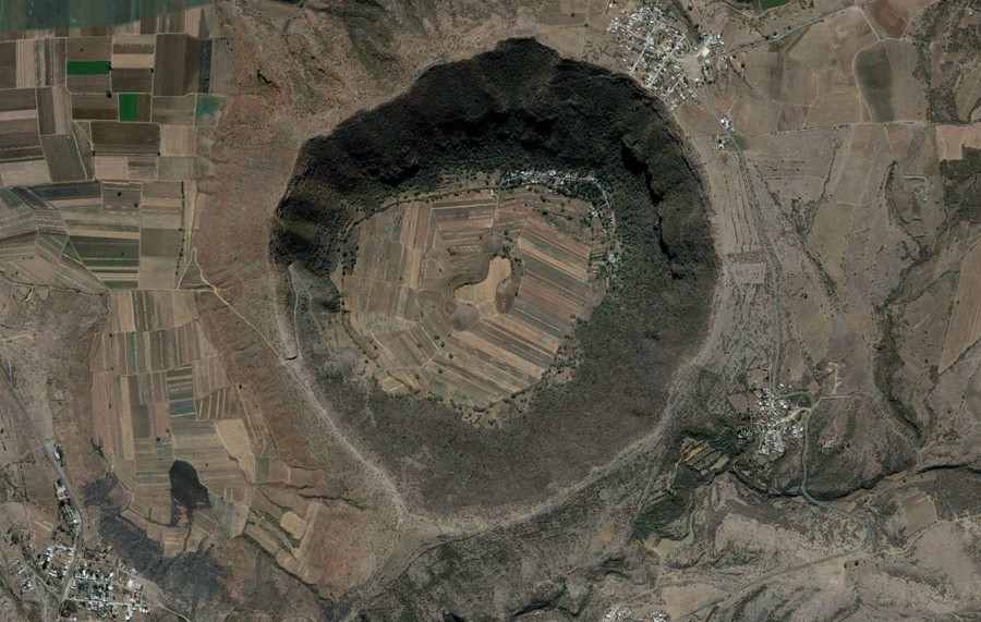
Read moreFarms inside a caldera near Valle de Santiago. #
© Google, Inc. -
-
![]() Read more
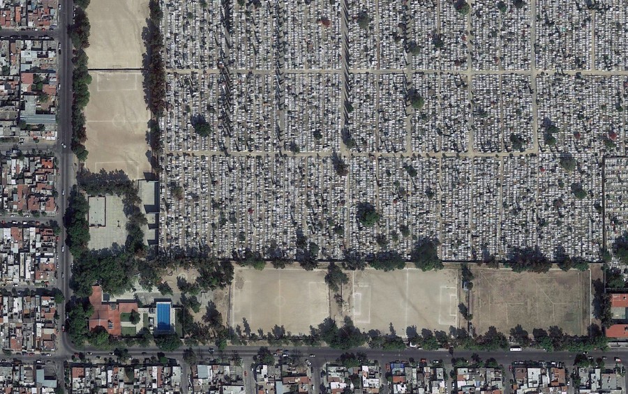
Read morePanteón Guadalajara, a cemetery in Guadalajara. #
© Google, Inc. -
![]() Read more
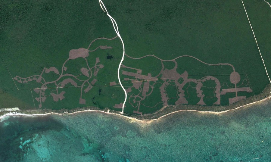
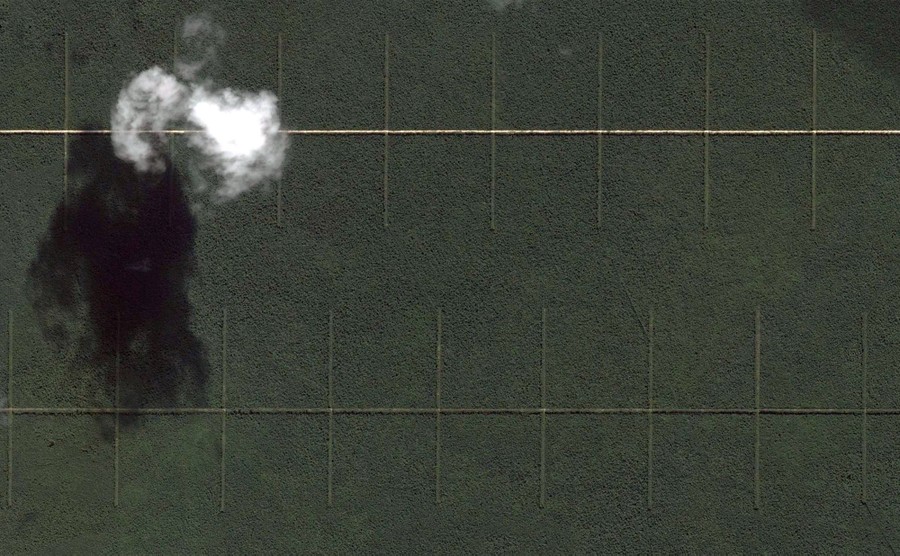
Read moreLines cut into the forest near San Miguel de Cozumel. #
© Google, Inc. -
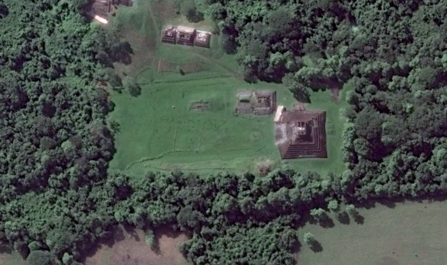
![]() Read more
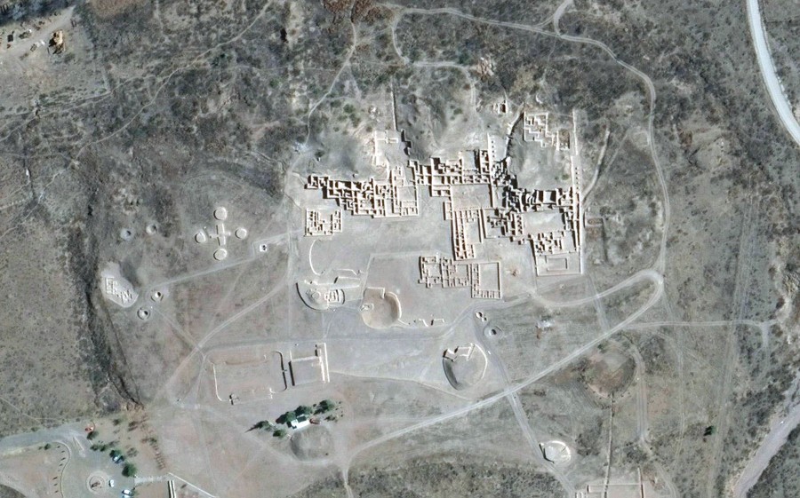
Read moreArchaeological ruins of Paquime, Casas Grandes. The site is attributed to the Mogollon culture, built around the 14th century. #
© Google, Inc. -
-
![]() Read more
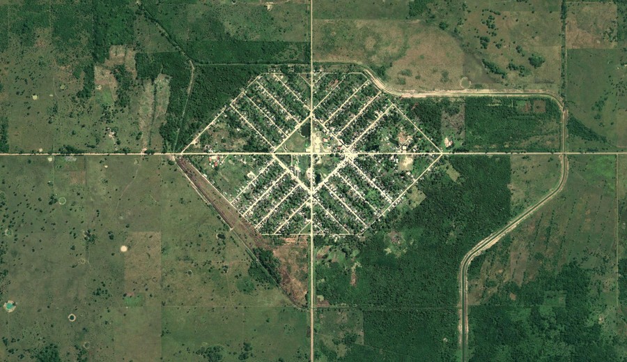
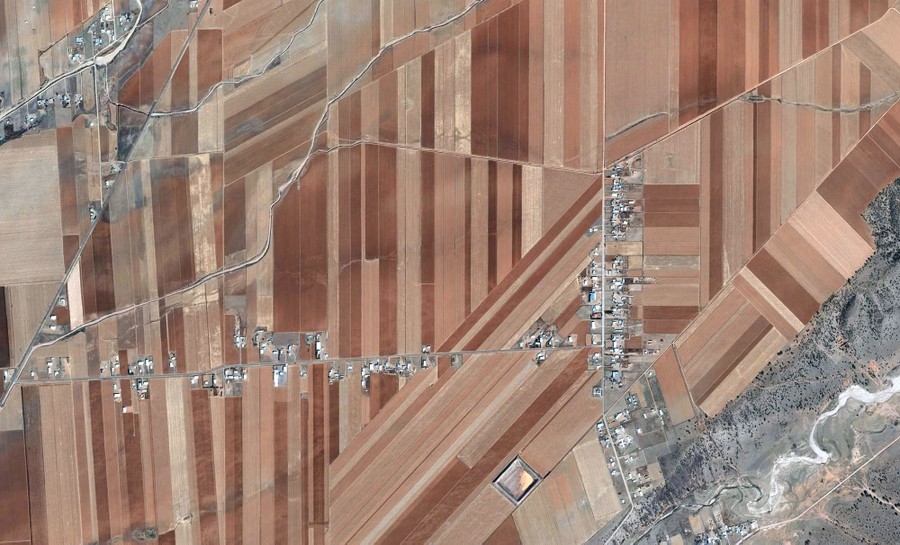
Read moreValle Hermoso, Tamaulipas. #
© Google, Inc. -
![]() Read more
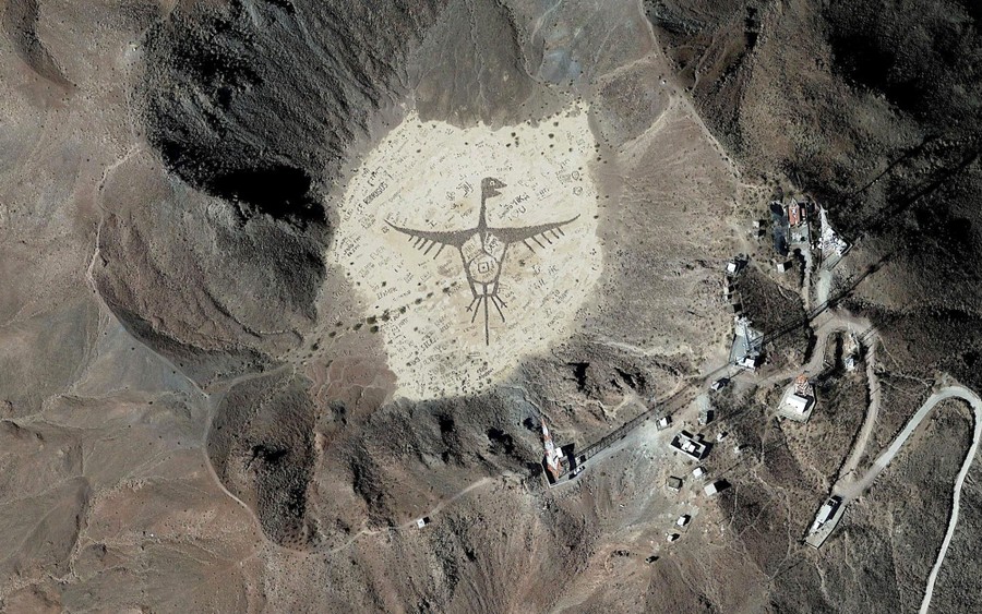
Read moreGraffiti inside a volcano, Cerro Prieto, near Michoacán de Ocampo, Baja California. #
© Google, Inc.
We want to hear what you think about this article. Submit a letter to the editor or write to letters@theatlantic.com.