Getty Images photographer Mario Tama just returned from the Arctic, after accompanying researchers with NASA's Operation IceBridge as they flew sets of eight-hour research flights above parts of Canada, Greenland, and the Arctic Ocean on their Arctic spring campaign. Scientists are monitoring Arctic ice loss and studying how polar ice has evolved over the past nine years. The flights were conducted aboard a retrofitted 1966 Lockheed P-3 aircraft, flying out of Thule Air Base in northwestern Greenland. Tama reports that “according to NASA scientists and the National Snow and Ice Data Center, sea ice in the Arctic appears to have reached the lowest maximum wintertime extent ever recorded on March 7.” And, if you enjoy these images, please see Tama’s shots from Antarctica last year.
Above Canada and Greenland With NASA's Operation IceBridge
-
![]() Read more
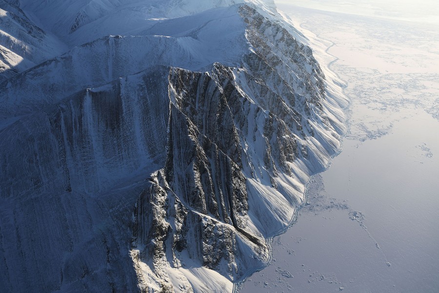
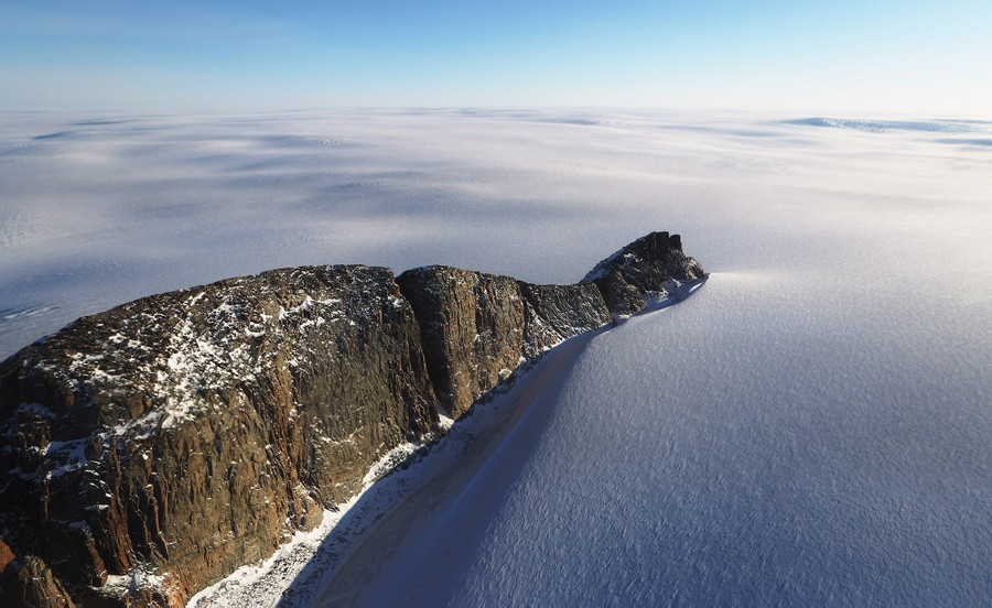
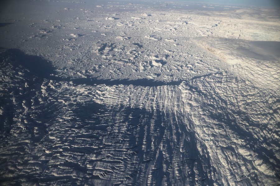
Read moreA section of an ice field is seen from NASA's Operation IceBridge research aircraft on March 29, 2017, above Ellesmere Island, Canada. The ice fields of Ellesmere Island are retreating due to warming temperatures. #
Mario Tama / Getty -
-
![]() Read more
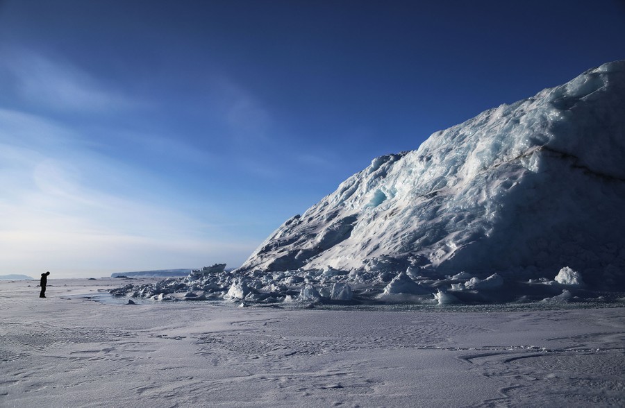
Read moreNASA project scientist Nathan Kurtz surveys an iceberg locked in sea ice near Thule Air Base on March 26, 2017 in Pituffik, Greenland. IceBridge team members took the rare opportunity to survey sea ice near the base from the ground. #
Mario Tama / Getty -
![]() Read more
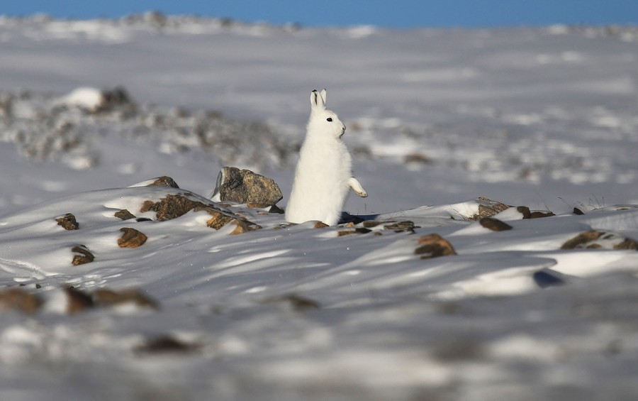
Read moreA snowshoe hare stands near Thule Air Base on March 25, 2017 in Pituffik, Greenland. #
Mario Tama / Getty -
![]() Read more
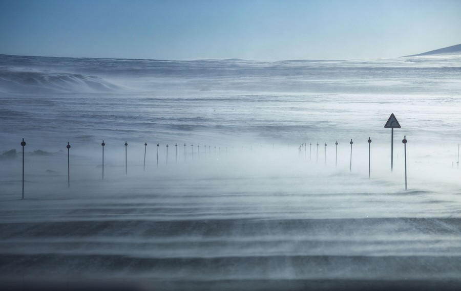
Read moreSnow blows near Thule Air Base on March 25, 2017 in Pituffik, Greenland. #
Mario Tama / Getty -
-
![]() Read more
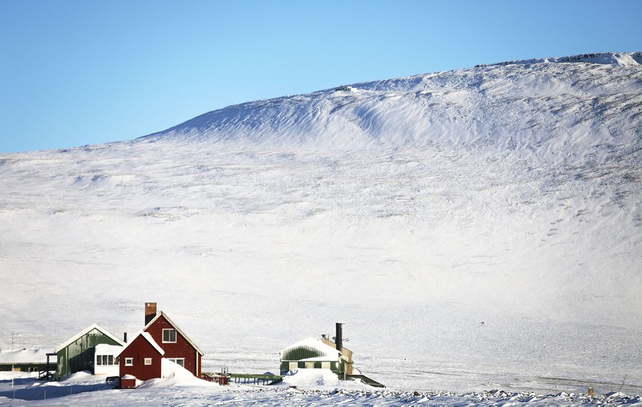
Read moreHouses stand near Thule Air Base on March 25, 2017. #
Mario Tama / Getty -
![]() Read more
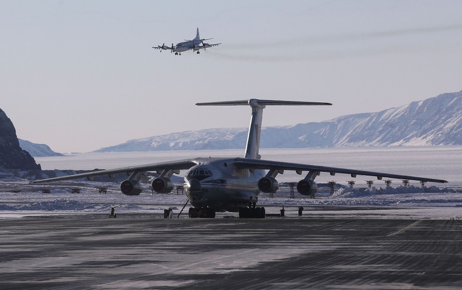
Read moreNASA's Operation IceBridge research aircraft (top) lands at Thule Air Base on March 24, 2017. #
Mario Tama / Getty -
![]() Read more
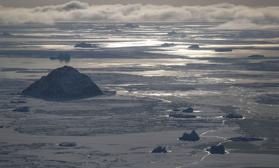
Read moreSea ice is seen from NASA's Operation IceBridge research aircraft off the northwest coast on March 30, 2017 above Greenland. #
Mario Tama / Getty -
-
![]() Read more
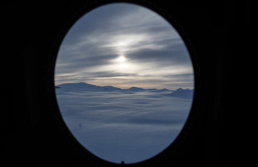
Read moreNASA avionics technician Lauren Prinski looks out a window of NASA's Operation IceBridge research aircraft on March 30, 2017. #
Mario Tama / Getty -
![]() Read more
Read moreAn iceberg is locked in sea ice as seen from NASA's Operation IceBridge research aircraft along the Upper Baffin Bay coast on March 27, 2017 above Greenland. Greenland's ice sheet is retreating due to warming temperatures. #
Mario Tama / Getty -
![]() Read more
Read moreIcebergs are locked in sea ice as seen from NASA's Operation IceBridge research aircraft along the Upper Baffin Bay coast on March 28, 2017. #
Mario Tama / Getty -
-
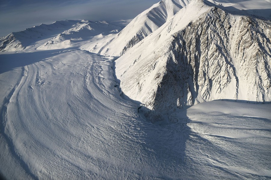
![]() Read more
Read moreA section of a glacier is seen from NASA's Operation IceBridge research aircraft on March 29, 2017 above Ellesmere Island, Canada. #
Mario Tama / Getty -
![]() Read more
Read moreSea ice is seen from NASA's Operation IceBridge research aircraft along the Upper Baffin Bay coast on March 27, 2017 above Greenland. #
Mario Tama / Getty -
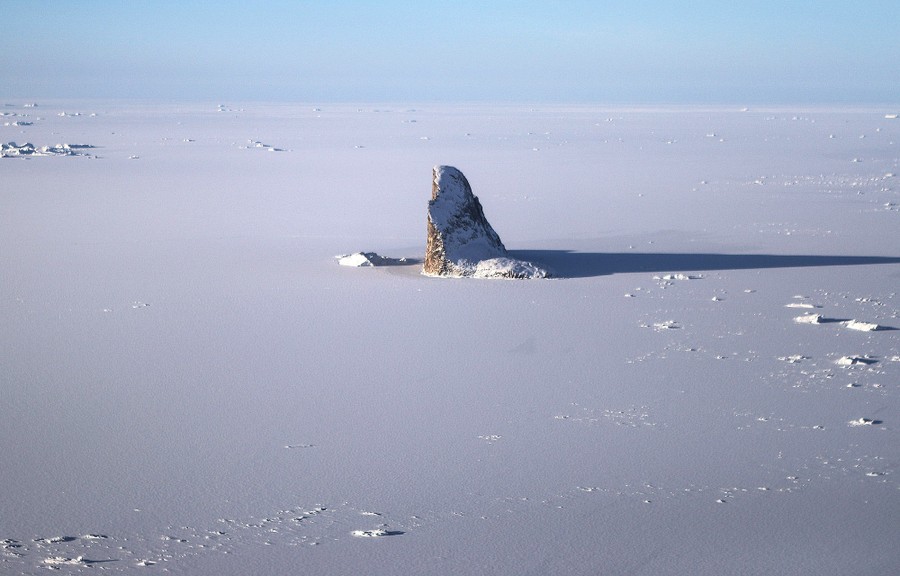
![]() Read more
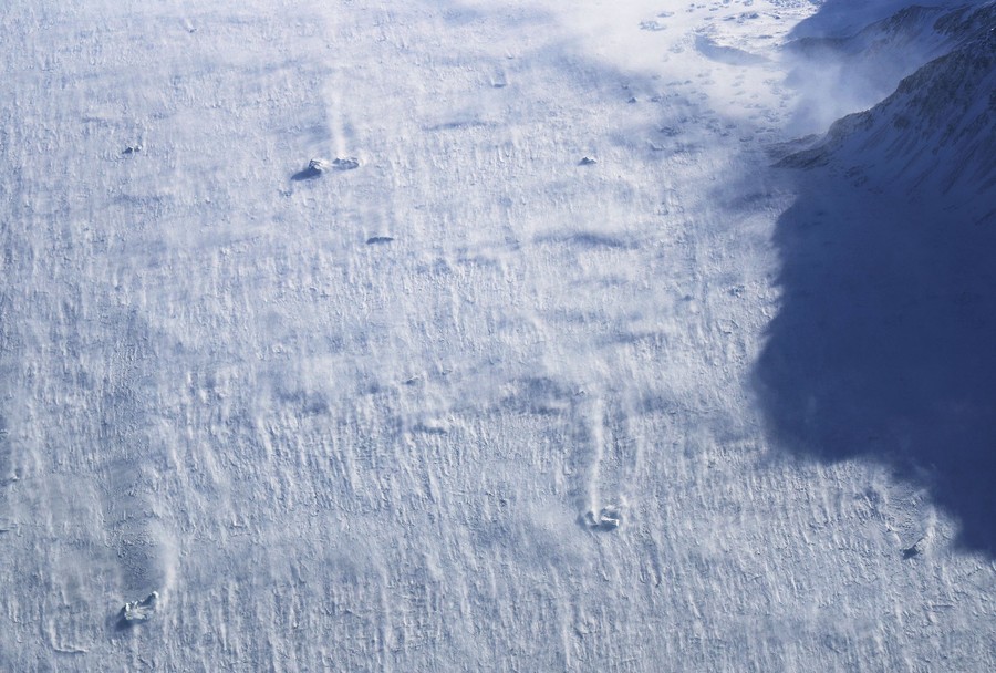
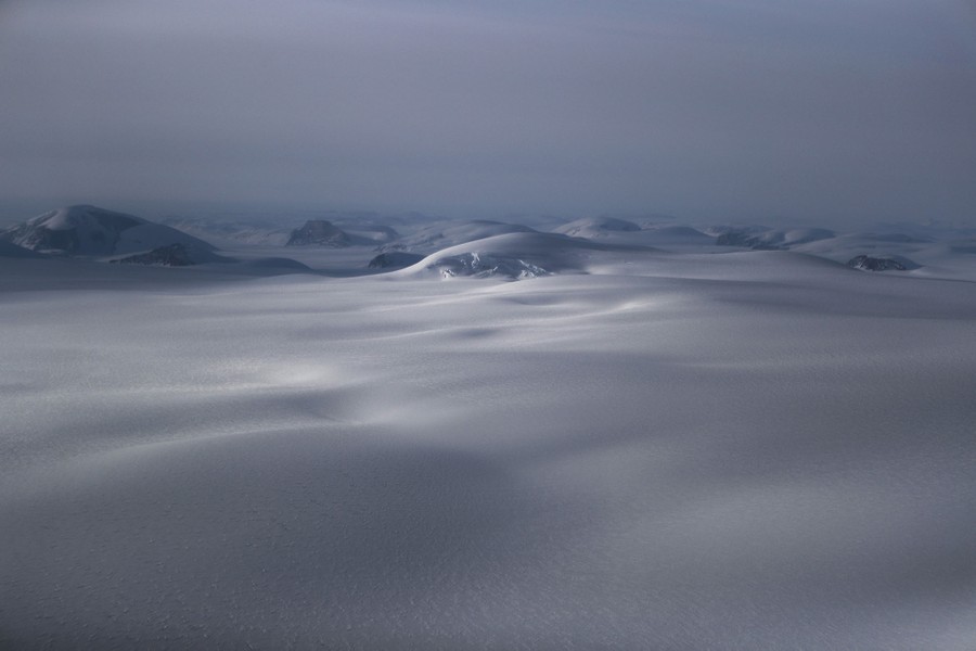
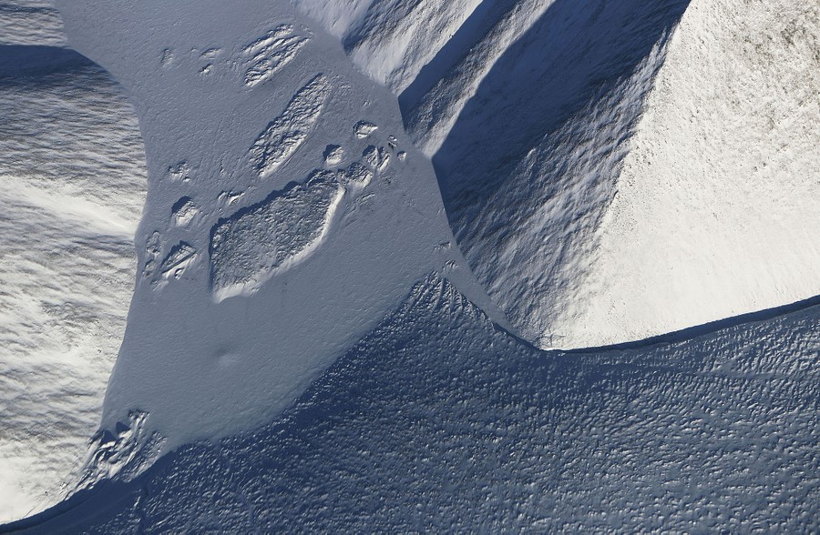
Read moreA section of an ice field seen above Ellesmere Island, Canada, on March 30, 2017. #
Mario Tama / Getty -
-
![]() Read more
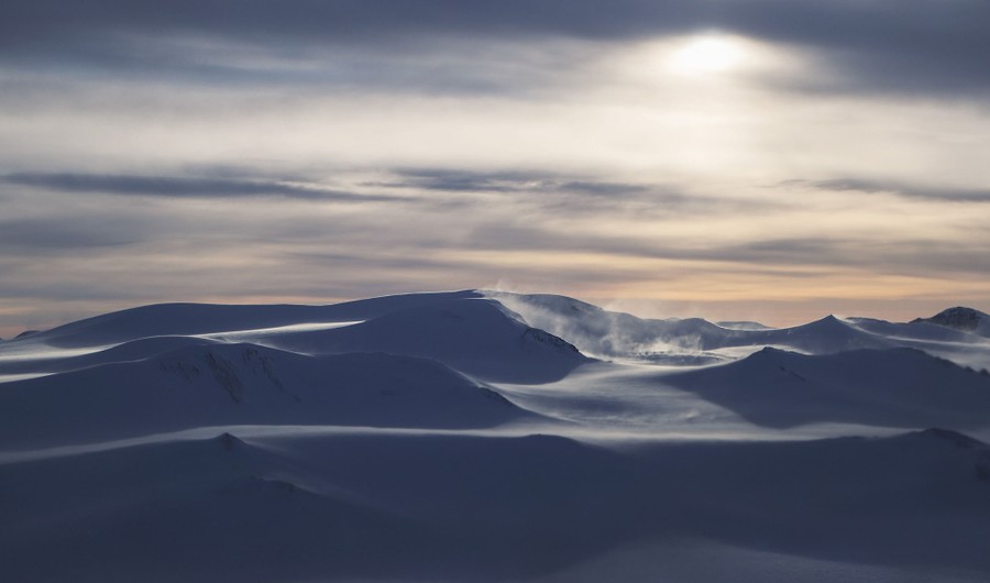
Read moreSnow blows off icebergs locked in sea ice seen above Ellesmere Island on March 30, 2017. #
Mario Tama / Getty -
![]() Read more
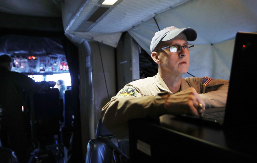
Read moreNASA mission scientist John Sonntag works by the cockpit aboard NASA's Operation IceBridge research aircraft on March 27, 2017. #
Mario Tama / Getty -
![]() Read more
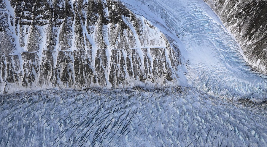
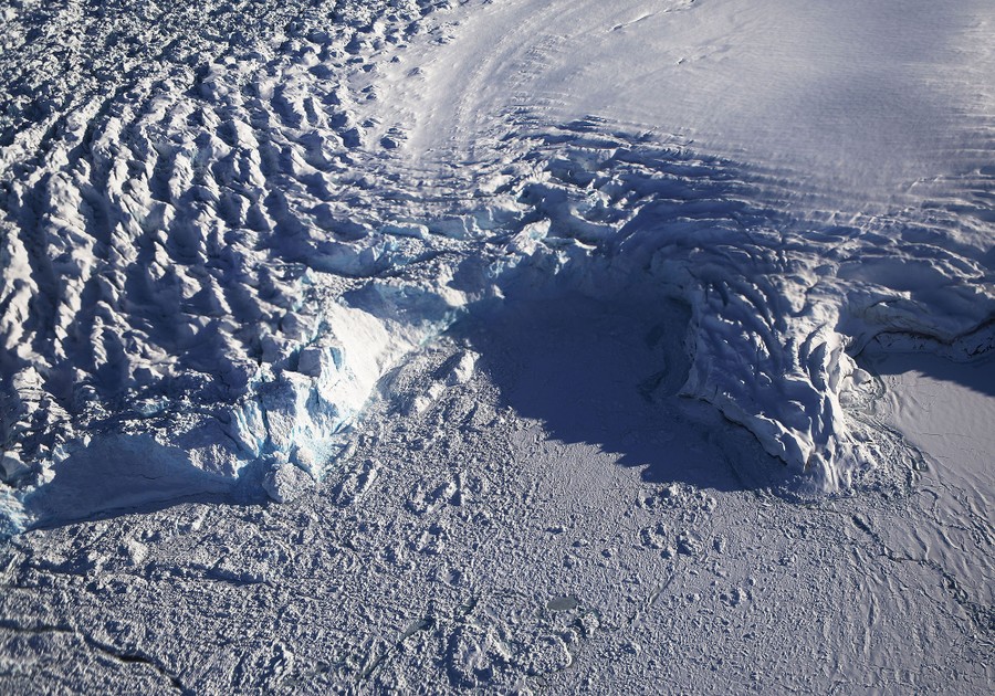
Read moreCrevasses in a glacier along the Upper Baffin Bay coast on March 27, 2017, seen from above Greenland. #
Mario Tama / Getty -
-
![]() Read more
Read moreA section of glacier is seen from NASA's Operation IceBridge research aircraft along Upper Baffin Bay coast on March 27, 2017. #
Mario Tama / Getty -
![]() Read more
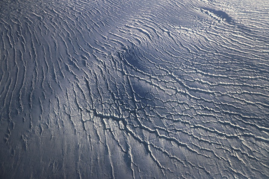
Read moreA section of ice sheet along the Upper Baffin Bay coast, seen on March 27, 2017 above Greenland. #
Mario Tama / Getty -
![]() Read more
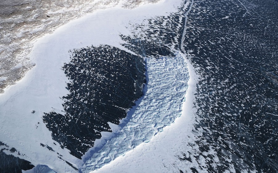
Read moreA section of ice sheet along Upper Baffin Bay on March 27, 2017. #
Mario Tama / Getty -
-
![]() Read more
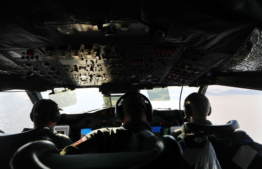
Read moreFlight crew sit in the cockpit of NASA's Operation IceBridge research aircraft above Upper Baffin Bay on March 27, 2017. #
Mario Tama / Getty -
![]() Read more
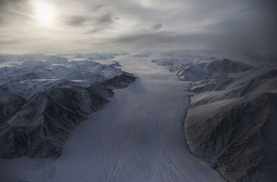
Read moreA glacier in Upper Baffin Bay on March 27, 2017. #
Mario Tama / Getty -
![]() Read more
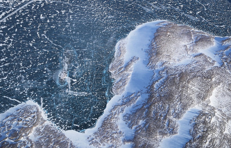
Read moreSea ice (top) meets land as seen from NASA's Operation IceBridge research aircraft along Upper Baffin Bay on March 27, 2017. #
Mario Tama / Getty -
-
![]() Read more
Read moreA section of an ice field above Ellesmere Island, Canada, photographed on March 29, 2017. #
Mario Tama / Getty -
![]() Read more
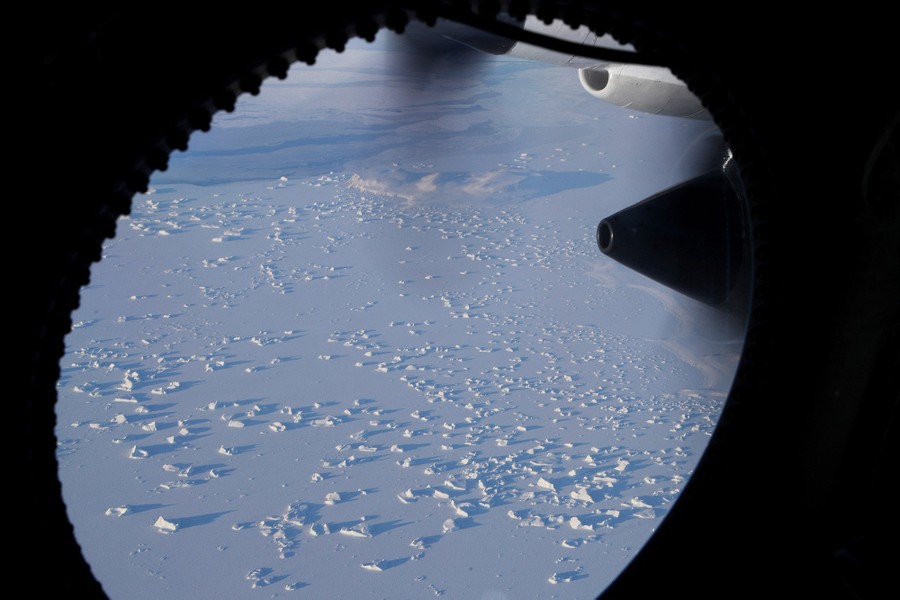
Read moreA section of an ice field is seen from the window of NASA's Operation IceBridge research aircraft on March 30, 2017 above Ellesmere Island. #
Mario Tama / Getty -
![]() Read more
Read moreAn ice field on Ellesmere Island, Canada, seen on March 30, 2017. #
Mario Tama / Getty -
-
![]() Read more
Read moreA glacier is seen from NASA's Operation IceBridge research aircraft along the Upper Baffin Bay coast on March 27, 2017. #
Mario Tama / Getty -
![]() Read more
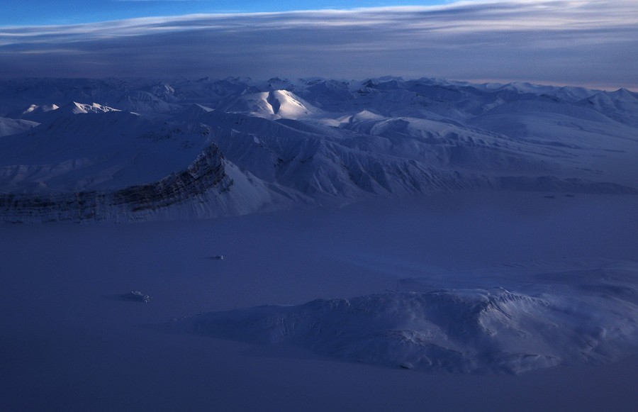
Read moreA glacier on Ellesmere Island, seen on March 29, 2017. #
Mario Tama / Getty -
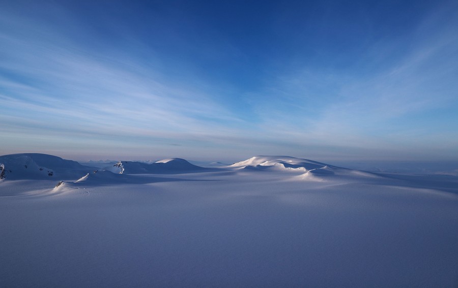
![]() Read more
Read moreA section of an ice field is seen from NASA's Operation IceBridge research aircraft on March 30, 2017 above Ellesmere Island, Canada. #
Mario Tama / Getty -

We want to hear what you think about this article. Submit a letter to the editor or write to letters@theatlantic.com.