There’s a deceptively simple number at the heart of the science of climate change: the sensitivity of Earth’s climate system to an addition of greenhouse gas like CO2. This variable gets defined in technical terms on several different timescales, but it all boils down to how much global warming we’ll get if we increase CO2 by a given amount.
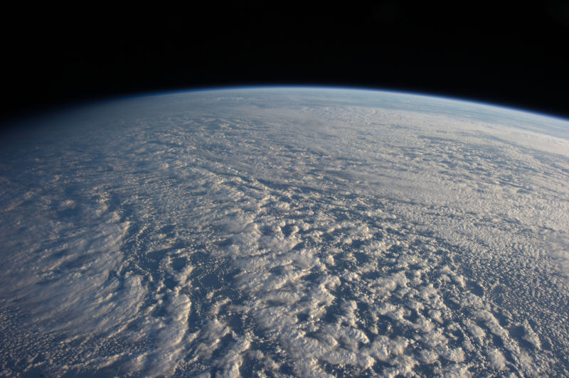
All kinds of complex interactions are contained within this number, including all the feedback loops that amplify or dampen the warming response. One of the harder feedbacks to pin down has been changes in clouds. As the world warms, more water vapor ends up in the atmosphere—and water vapor is an important greenhouse gas. But the bright, low clouds that water vapor can form reflect sunlight, shading and cooling the Earth.
It turns out the net result of increased water vapor enhances warming rather than limiting it. A new study by Lawrence Livermore National Laboratory’s Chen Zhou, Mark Zelinka, and Stephen Klein reveals an interesting interaction that makes this even more complicated. It’s not enough to figure out what clouds will do in general—there's not some single number that you can get to stand in for clouds. Instead, there are spatial patterns to clouds' effects, and they vary over time. This has some pretty interesting implications for understanding the last few decades and what’s coming in the future.
The researchers used a number of climate model simulations of the last century-and-a-half to examine how this works. Some simulations were run with all the historical changes to “forcings” like greenhouse gas concentrations and solar activity, as well as the observed patterns of sea surface temperatures. Other simulations were run with a twiddled knob—either holding the forcings constant at their pre-Industrial-Revolution levels or their current levels or removing the long-term warming trend from sea surface temperatures.
By comparing the balance of energy entering and leaving these virtual atmospheres to the global temperature change, researchers could work out the contribution of the cloud feedback over time. That contribution varied significantly from decade to decade. Even though clouds were an amplifying feedback overall, there were periods of time where they counteracted warming.
In fact, the last few decades were one of those times. The warmer western waters of the tropical Atlantic and Pacific Oceans have warmed faster than the cooler eastern waters since about 1980. That has a lot to do with the ebb and flow of natural circulation patterns, although human air pollution may have played a role, too.
Air tends to rise above the warmer western waters and descend in the cooler region. The bigger the difference in temperature between the two regions, the more cloud cover you get over the cooler waters, trapped under the cap of warm, descending air. That’s enough to increase the total global cloud cover a bit, and therefore this reflects more sunlight back into space. When all this swings in the other direction, you end up with less cloud cover and a stronger amplifying contribution to warming.
With this understanding, it's possible to tell what clouds have been up to lately. And since the 1980s, they have apparently been helping us out by limiting climate change. In other words, clouds have had a cooling influence over the last few decades.
This has some pretty interesting implications. The search for certainty on the magic number that is Earth’s climate sensitivity has proceeded along several different routes. Researchers have examined records of past climate changes, run their climate models, and analyzed the changes over the past century. Of the three methods, analyzing the past century has tended to yield a lower number for sensitivity than the others. That's partly because of overly simplified estimates of some forcings like sunlight-reflecting air pollution.
But it looks like recent cloud behavior has not been representative of long-term behavior, which would pull down sensitivity estimates based on recent temperatures. Accounting for this factor may erase the remaining discrepancy between the three types of estimates, increasing our confidence in the answer.
What’s more, the researchers note that this recent pattern of cloud behavior could even have had a small role in the slightly lower temperatures seen in the 2000s (when the cloud cover effect also peaked), which was primarily the result of a run of La Niña years caused by Pacific wind patterns.
So even though 2014 and 2015 set new global temperature records (and 2016 will, again), it seems that we may have been somewhat fortunate over the past few decades. As NASA’s Kate Marvel explained to Ars, “In the future, the warming of the whole surface will probably dwarf these regional temperature variations, and this more uniform pattern will lead to reductions in the reflecting clouds. The authors are saying, basically, that we've gotten lucky recently—low cloud cover has increased, reflected more sunlight back to space, and slowed down global warming. But don't expect this to persist in the future.”
“To me, the upshot of this work (as well as some previous work that this builds on) is that ‘climate sensitivity’ is not a single number, but can depend on other factors,” Texas A&M’s Andrew Dessler told Ars. “If one looks at the late 20th century, one might infer that a warming climate increased low clouds—a negative cloud feedback. But that's just a temporary conclusion. Ultimately, those places must warm and the low clouds will burn off, eventually generating a positive cloud feedback and a bigger climate sensitivity.”
Nature Geoscience, 2016. DOI: 10.1038/NGEO2828 (About DOIs).
reader comments
64