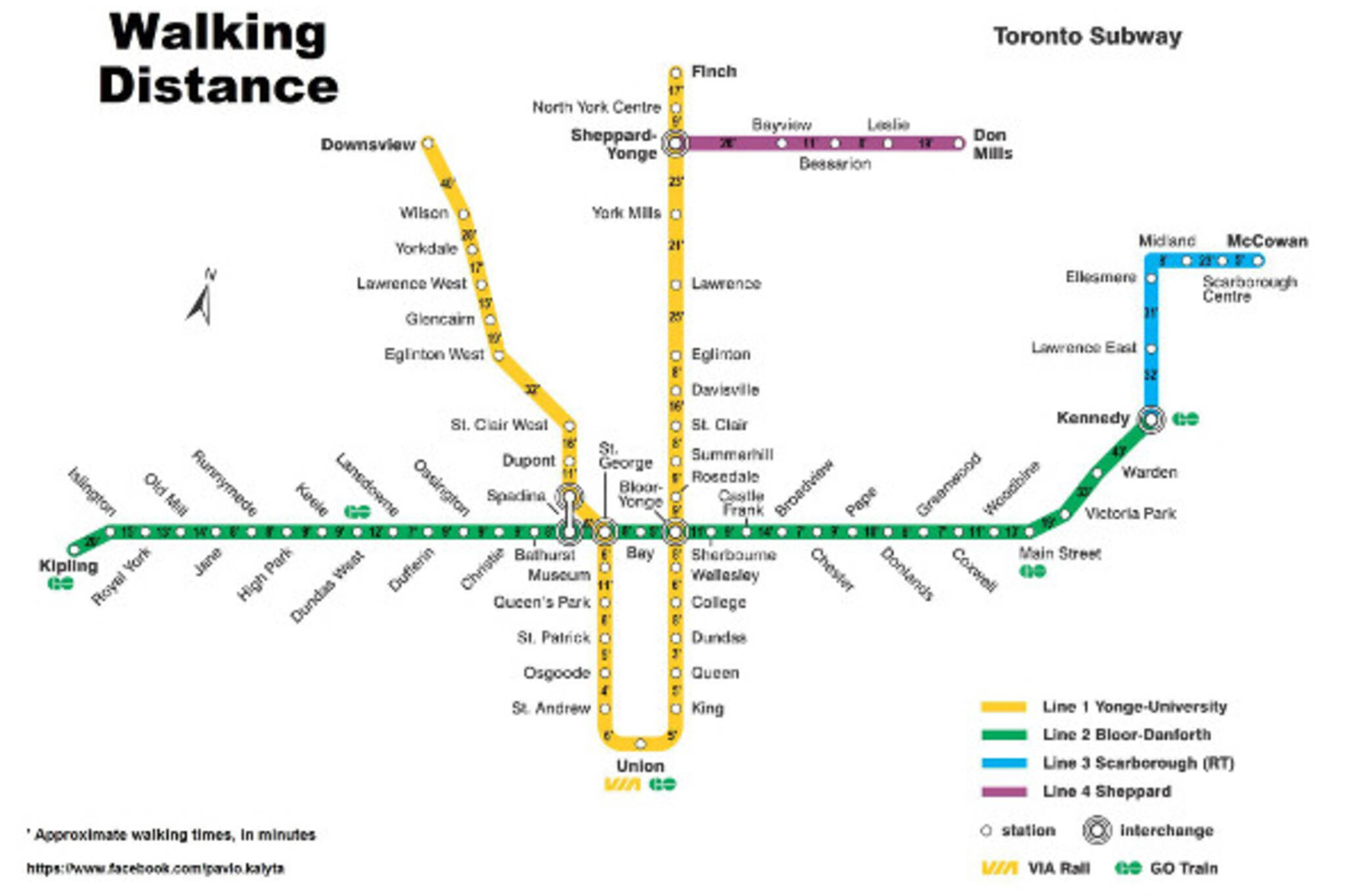
Map shows walking times between TTC subway stops
How long will it take you to walk from Bloor to Queen Station - you know, if there's a major subway delay or something and you don't feel like taking a shuttle bus? Now, you no longer have to guess thanks to a handy subway Walking Distance Map.
Pavlo Kalyta, an assistant professor of accounting and sustainability at Queen's University, created the map along with one for Montreal's Metro system.
Kalyta tells us that he created the map to give practical information to tourists and to encourage us locals to be more active.
You can check out the full-size map here. And if you can, why not get off the train one stop early and walk towards your destination?
Latest Videos
Latest Videos
Join the conversation Load comments