How a California Earthquake Becomes the News: An Extremely Precise Timeline
An amazing feat of algorithmic journalism — and data gathering
Early Monday morning, Los Angeles suffered the strongest earthquake it had seen in 20 years. The 4.4-magnitude seismic event woke up sleeping Angelenos, but thankfully did little additional damage.
The quake came at 6:25 a.m. Eight minutes later, the Los Angeles Times had posted a story about the quake. It had an odd final paragraph:
This information comes from the USGS Earthquake Notification Service and this post was created by an algorithm written by the author.
Indeed, the a story was written by a program, but read like normal newspaper prose. In the eight minutes that passed—from tremor to coverage—what happened?
6:25 a.m., 36.8 seconds. On Monday, six miles underground—a fault line slipped.
The vibration from that slip traveled upward. It took about a second to travel the 9.9 km until it hit the ground near Meadowcrest Road in Westwood, Los Angeles, a few blocks away from the Bel-Air Presbyterian Church.
It kept traveling, outward, rippling.
When we imagine earthquakes, we often imagine concentric rings of vibrations traveling outward from the center. While that’s a fine description of what the quake feels like on the ground, it belies that earthquakes are 3D. After a fault slips at a quake’s hypocenter, it emits energy outward in an expanding sphere. The first place that sphere touches the ground becomes the epicenter. An earthquake seems to ring outward from that spot, but those concentric rings are really just where that expanding sphere of vibrations meets the ground.
6:25 a.m., 37 seconds. When I talked to Douglas Given, a geophysicist at the United States Geological Survey (USGS), he estimated it took Monday’s quake 1 to 1.5 seconds to travel to reach the epicenter. After it hit the epicenter, it expanded nearly three miles before a piece of government equipment noticed.
6:25 a.m., 38.24 seconds. In the Santa Monica mountains, the first USGS seismograph registers the quake.
The USGS operates 360 sensors stations through southern California. They’re spread out across the land, in mountains and cities, farmland and fields, listening. Each sensor station has two kinds of seismographs: An extremely sensitive “weak motion sensor” that registers tiny shakes, vibrations that humans can’t feel; and a “strong motion sensor” that registers big movements.
The weak motion sensors can register “negative magnitude-value” quakes, Given tells me. While we often think of the magnitude scales used for earthquakes as “starting” at zero, that’s not true: The degrees of earthquake magnitude are somewhat arbitrary. While humans can rarely sense quakes below magnitude-2, quakes can get much subtler.
In southern California, the USGS doesn’t operate these double sensors alone. They do so in conjunction with the California Institute of Technology in Pasadena. This kind of university-agency partnership is common for the USGS: There are about 20 of these regional offices throughout the country, each running a network of seismographs. In northern California, the USGS partners with the University of California Berkeley. Together, the two seismic networks employ about 25 people.
In the south, the USGS also gathers data from about a hundred other seismographs. The state’s Department of Water Resources runs seismic sensors, as does the local utility company, Pacific Gas and Electric. Some of these only activate when an earthquake triggers them.
Each seismograph has three components, which can each measure movement along one vector. The three combined lets them track all three dimensions: vibrations along the axes north-south, east-west, and up-down. The weak sensors “start clipping”—in other words, top out—around magnitude 3 or 3.5 quakes.
On Monday, then, the USGS first relied on its big sensors, its strong motion seismographs.
Three seismographs recognized the quake shortly after the Santa Monica mountain sensors. They measured it at:
6:25 a.m., 38.94 seconds, in Northridge, CA;
6:25 a.m., 39.53 seconds, in Burbank, CA; and
6:25 a.m., 39.78 seconds, in Santa Montica proper.
All four sensors are continuously linked to a data center in California. (The agency wants to keep its data local, to increase security and reduce latency.) The USGS has two different systems for identifying quakes: an early warning system, and a “routine” system. Once those four sensors triggered, the USGS early warning system knew it had an earthquake on its hands.
The USGS didn’t alert the public, though. The early warning system is insufficiently funded—it hasn’t been vetted well enough for public use—so the USGS doesn’t share those results. Nearly three seconds elapsed between when the fault slipped and when the U.S. government knew what had happened—but once it knew, it couldn’t do anything.
The USGS computer system waited, instead, for its routine system to account for the quake. The routine system is slower and more exact. It doesn’t issue an alert until 90 seconds after the first tremor. So the USGS system, after receiving data from many, many more of its seismic sensors across the region, published its first standard alert about the earthquake at
6:27 a.m.
The USGS only promises to publish information this fast about California quakes—“in a few minutes” is the language it uses. Worldwide quakes may take a couple hours to process. But once it publishes an earthquake report, it distributes that information over many channels: Twitter, a Google Earth file, a news feed like RSS, and email.
== PRELIMINARY EARTHQUAKE REPORT ==
Region: GREATER LOS ANGELES AREA, CALIFORNIA
Geographic coordinates: 34.133N, 118.487W
Magnitude: 4.7
Depth: 8 km
Universal Time (UTC): 17 Mar 2014 13:25:36
Time near the Epicenter: 17 Mar 2014 06:25:37
Local standard time in your area: 17 Mar 2014 05:25:36
Location with respect to nearby cities:
9 km (5 mi) NNW of Westwood, California
10 km (6 mi) NW of Beverly Hills, California
12 km (7 mi) W of Universal City, California
12 km (7 mi) N of Santa Monica, California
562 km (348 mi) SSE of Sacramento, California
That email arrived in a special inbox which Los Angeles Times developer Ken Schwencke set up three years ago.
After Japan’s 2011 earthquake, Schwencke began exploring ways to use USGS data to automatically alert journalists and even write news stories. He wrote Quakebot, a little set of processes triggered by the arrival of a USGS earthquake alert email.
And on Monday, once that inbox—operated through the service Mailgun—received the USGS alert, it sent it to a server. The server parsed the email, looking to answer three questions:
- Is the quake in LA, with greater than 2.5-magnitude?
- Is the quake in California, with greater than 3.0-magnitude?
- Is the quake in the U.S., with greater than a 4.5-magnitude?
If only the last question is answered affirmatively, the bot emails the paper’s national reporters and editors—a kind of early alert to a developing story. If either of the first two questions are affirmative, though, it both alerts the metro desk to the quake and writes a simple post.
You’ll see, looking at the email above, how straightforwardly the data is presented. Schwencke’s bot just wraps that data in sentences. It writes adjectives like “powerful” or “weak” depending on magnitude and “shallow” or “deep” depending on depth. Then it screenshots a Bing map, draws the ring of vibrations around it, writes a headline, and drops all that into a post.
And then—being a good reporter—it pings one of the LAT’s copyeditors. Its email—using the magic word!—went out at…
6:28 a.m. It said:
This is a robopost from your friendly earthquake robot. Please copyedit & publish the story.
It then linked to the story and asks for the copyeditor’s help with news judgement:
If the city referenced in the headline is relatively unknown, but the earthquake occurred close to another, larger city, please alter the headline and body text to put that information first.
I am currently not smart enough to make these decisions on my own, and rely on the help of intelligent humans such as yourselves.
And here comes the longest gap in the eight minutes. The earthquake rumbled at 6:25; the first sensor detected it seconds later. The USGS announced the quake at 6:27. A minute later, the Los Angeles Times had a news story, already written but not yet posted, about the seismic event.
Schwencke was still in bed. Like many Angelenos, he’d been woken up my the rumble.
“I felt it, rolled out of bed, and booted up my computer,” he told me on Tuesday. He knew what had happened. He also had to wait for his web connection to come in.
At 6:32 a.m., a copy editor began to look at the post. Schwencke had finally gotten a view of the post too. He checked—with “bleary eyes”—to make sure there were no glaring spelling or grammar errors.
6:33 a.m. The post went live.
“Since I felt it, I assumed most of Los Angeles County had too, so I hit the live button myself,” he told me. With the headline “Earthquake: 4.7 quake strikes Los Angeles, centered near Westwood,” that post looked like this:
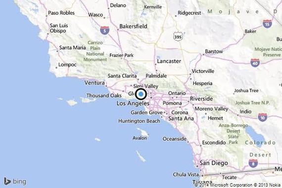
A shallow, magnitude-4.7 earthquake was reported Monday morning five miles from Westwood, according to the U.S. Geological Survey. The temblor occurred at 6:25 a.m. PDTat a depth of 5.0 miles.
According to the USGS, the epicenter was six miles from Beverly Hills, seven miles from Universal City and seven miles from Santa Monica.
In the past 10 days, there have been no earthquakes of magnitude 3.0 or greater centered nearby.
This information comes from the USGS Earthquake Notification Service and this post was created by an algorithm written by the author.
Four minutes later, Schwencke received an email from the copyeditor. The post had been back-read and looked good.
According to Schwencke, there have been some 70 updates to the post since then. It now even bears a different byline. And while Schencke’s work is gone, his earthquake bot also attended to two aftershocks to Monday’s 4.4 quake. Its story on one of them, a 2.7 earthquake near Westwood, is still online.
You might notice that the information in its initial post about the big quake was wrong. Monday’s tremor, initially judged a 4.7, was soon revised down to 4.4. When it received this alert, Quakebot emailed the copydesk asking for a change—just like a real reporter.
Schwencke’s story-writing bot has been around for nearly three years, but this is the first major earthquake in LA, and, thus, the first time people really noticed it. Indeed, all throughout Monday, screenshots of the initial version of the story whizzed around Journalism Twitter. A story-writing bot! Oh my word!
Scott Klein, senior editor of news applications at ProPublica, had predicted that in 2014, journalists would “be scooped by a reporter who knows how to program”—and, here, it had already happened! The little bot reminded folks, too, of Narrative Science, the Chicago-based startup that converts data (and “finds insights” inside it) and exports human-readable prose.
Schwencke’s bot is indeed awesome. It really did scoop every other journalist to a big story, a victory not only journalistic but also—when Google News rewards speed—financial. But it stands in for a much larger system. Government and academic scientists, technicians, and programmers allowed Quakebot to be born. They developed the networked seismographs, installed, monitored, and maintained them. They made sure all the telemetry works in case of emergency, and set up systems to quickly distribute the news—and measurements—of an earthquake. Schwencke’s bot is only one node, one terminal tendril, of a system that reaches far and rewards many.
Quakebot, in other words, isn’t just a “future of news” parable. It’s a story about data.