Home & Garden
Hazardous Weather Outlook Issued: Small Risk of Severe Thunderstorms
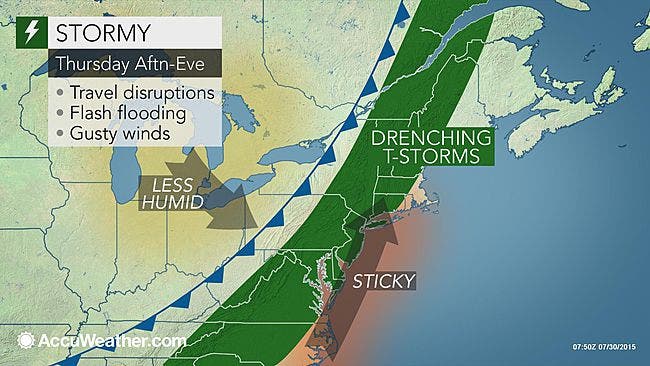
We let you know when the storms are expected Thursday, and how they're bringing Bronxville, Eastchester and Tuckahoe good weekend weather.

The National Weather Service has issued a “Hazardous Weather Outlook” for Putnam, Rockland and Westchester counties for the chance of Thursday thunderstorms.
“THERE IS A MARGINAL RISK FOR STRONG TO SEVERE THUNDERSTORMS THIS AFTERNOON AND EVENING. THE MAIN THREAT IS FROM DAMAGING WIND GUSTS,” the NWS shouts.
Bill Potter of Hudson Valley Weather says the cold front is coming faster than expected, and storms along its boundary could form as early as noon for the northwesternmost communities.
Find out what's happening in Bronxville-Eastchesterwith free, real-time updates from Patch.
“Due to the changing wind directions along this frontal boundary, a few of these storms could become severe. There is roughly a 5% chance that a storm within 25 miles of your location could contain a damaging wind gust,” he says. “In addition to the severe potential, these storms could also contain small hail and heavy downpours.”
You can track them on the HVW Interactive Radar.
Find out what's happening in Bronxville-Eastchesterwith free, real-time updates from Patch.
“Travel may be slowed for a time as the storms roll though, especially if they hit during the heart of rush hour,” said AccuWeather Meteorologist Brian Lada.
Friday, Saturday and Sunday, will be the beneficiaries of this “cold” front coming in. It’ll be a nice summer weekend: sunny, low humidity and temperatures only in the upper 80s.
Get more local news delivered straight to your inbox. Sign up for free Patch newsletters and alerts.


