Home & Garden
Warmer Weekend But Snow, Storm Chances Upcoming for Tarrytown, Sleepy Hollow
On the whole the weekend looks good, but more rain and snow could hit Sunday night.

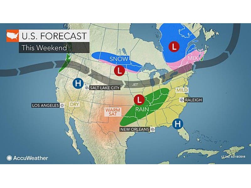
After last weekend’s winter array, with arctic temps, snow, rain and thaw, everyone’s ready for a couple of days of mild-mannered weather.
And it looks like we will get one, but we still have to get through the chance of a wintry mix of rain or snow as clouds roll in and out Friday night. The farther south in Westchester County the less of a chance for any precipitation.
Whatever happens overnight, things should clear up by morning.
Find out what's happening in Tarrytown-Sleepy Hollowwith free, real-time updates from Patch.
“The southwest wind is in full force by Saturday, and that should do 2 things… help clear out some of the clouds, and push temperatures up into the 50s for daytime highs,” says Bill Potter of Hudson Valley Weather. “Saturday has the potential to be a very nice day for mid-February. Sunday doesn’t look too bad either, with temps climbing close to 50° for a high.”
Want details: Click here for Tarrytown and Sleepy Hollow’s in-depth weather forecast.
Find out what's happening in Tarrytown-Sleepy Hollowwith free, real-time updates from Patch.
But don’t break out the patio furniture just yet.
The National Weather Service said rain and/or snow are possible Sunday night, which could affect the Monday commute.
A storm from the Gulf of Mexico will turn northward along the Atlantic Seaboard next week, potentially resulting in a snowstorm for parts of the East. Plus colder air will return, and highs in the 30s and 40s will again replace 50-degree temperatures, said Alex Sosnowski, AccuWeather.com Senior Meteorologist
MAP: AccuWeather.com
Get more local news delivered straight to your inbox. Sign up for free Patch newsletters and alerts.
